You are here: Home > Network List > G - GEOSCOPE Stations List
> Station INU Inuyama, Japan > Earthquake Result Viewer
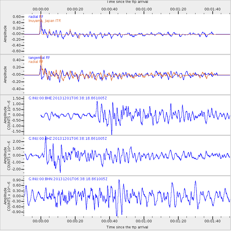
INU Inuyama, Japan - Earthquake Result Viewer
*The percent match for this event was below the threshold and hence no stack was calculated.
| Earthquake location: |
Northern Sumatra, Indonesia |
| Earthquake latitude/longitude: |
2.0/96.8 |
| Earthquake time(UTC): |
2013/12/01 (335) 06:29:57 GMT |
| Earthquake Depth: |
20 km |
| Earthquake Magnitude: |
6.0 MWW, 5.9 MWB, 5.9 MWW, 6.1 MWC |
| Earthquake Catalog/Contributor: |
NEIC PDE/NEIC COMCAT |
|
| Network: |
G GEOSCOPE |
| Station: |
INU Inuyama, Japan |
| Lat/Lon: |
35.35 N/137.03 E |
| Elevation: |
132 m |
|
| Distance: |
49.9 deg |
| Az: |
43.631 deg |
| Baz: |
237.518 deg |
| Ray Param: |
$rayparam |
*The percent match for this event was below the threshold and hence was not used in the summary stack. |
|
| Radial Match: |
72.334625 % |
| Radial Bump: |
400 |
| Transverse Match: |
68.88166 % |
| Transverse Bump: |
400 |
| SOD ConfigId: |
626651 |
| Insert Time: |
2014-04-19 22:26:54.951 +0000 |
| GWidth: |
2.5 |
| Max Bumps: |
400 |
| Tol: |
0.001 |
|
Signal To Noise
| Channel | StoN | STA | LTA |
| G:INU:00:BHZ:20131201T06:38:18.861005Z | 4.3173203 | 1.0048661E-6 | 2.3275227E-7 |
| G:INU:00:BHN:20131201T06:38:18.861005Z | 0.7021787 | 1.8610704E-7 | 2.6504227E-7 |
| G:INU:00:BHE:20131201T06:38:18.861005Z | 2.8804677 | 4.7235048E-7 | 1.6398396E-7 |
| Arrivals |
| Ps | |
| PpPs | |
| PsPs/PpSs | |


