You are here: Home > Network List > IU - Global Seismograph Network (GSN - IRIS/USGS) Stations List
> Station PMG Port Moresby, New Guinea > Earthquake Result Viewer
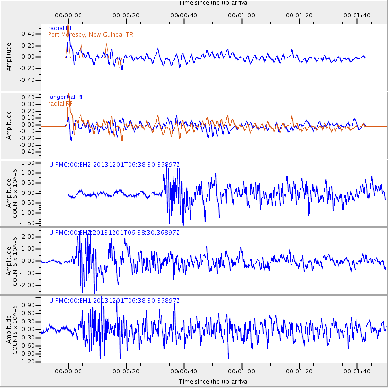
PMG Port Moresby, New Guinea - Earthquake Result Viewer
*The percent match for this event was below the threshold and hence no stack was calculated.
| Earthquake location: |
Northern Sumatra, Indonesia |
| Earthquake latitude/longitude: |
2.0/96.8 |
| Earthquake time(UTC): |
2013/12/01 (335) 06:29:57 GMT |
| Earthquake Depth: |
20 km |
| Earthquake Magnitude: |
6.0 MWW, 5.9 MWB, 5.9 MWW, 6.1 MWC |
| Earthquake Catalog/Contributor: |
NEIC PDE/NEIC COMCAT |
|
| Network: |
IU Global Seismograph Network (GSN - IRIS/USGS) |
| Station: |
PMG Port Moresby, New Guinea |
| Lat/Lon: |
9.40 S/147.16 E |
| Elevation: |
90 m |
|
| Distance: |
51.4 deg |
| Az: |
103.657 deg |
| Baz: |
280.207 deg |
| Ray Param: |
$rayparam |
*The percent match for this event was below the threshold and hence was not used in the summary stack. |
|
| Radial Match: |
78.84908 % |
| Radial Bump: |
400 |
| Transverse Match: |
63.890022 % |
| Transverse Bump: |
400 |
| SOD ConfigId: |
626651 |
| Insert Time: |
2014-04-19 22:29:58.088 +0000 |
| GWidth: |
2.5 |
| Max Bumps: |
400 |
| Tol: |
0.001 |
|
Signal To Noise
| Channel | StoN | STA | LTA |
| IU:PMG:00:BHZ:20131201T06:38:30.36897Z | 15.572296 | 9.421604E-7 | 6.0502344E-8 |
| IU:PMG:00:BH1:20131201T06:38:30.36897Z | 1.9248879 | 2.3066323E-7 | 1.1983204E-7 |
| IU:PMG:00:BH2:20131201T06:38:30.36897Z | 4.9441524 | 4.746911E-7 | 9.601061E-8 |
| Arrivals |
| Ps | |
| PpPs | |
| PsPs/PpSs | |


