You are here: Home > Network List > TA - USArray Transportable Network (new EarthScope stations) Stations List
> Station R11A Troy Canyon, Currant, NV, USA > Earthquake Result Viewer
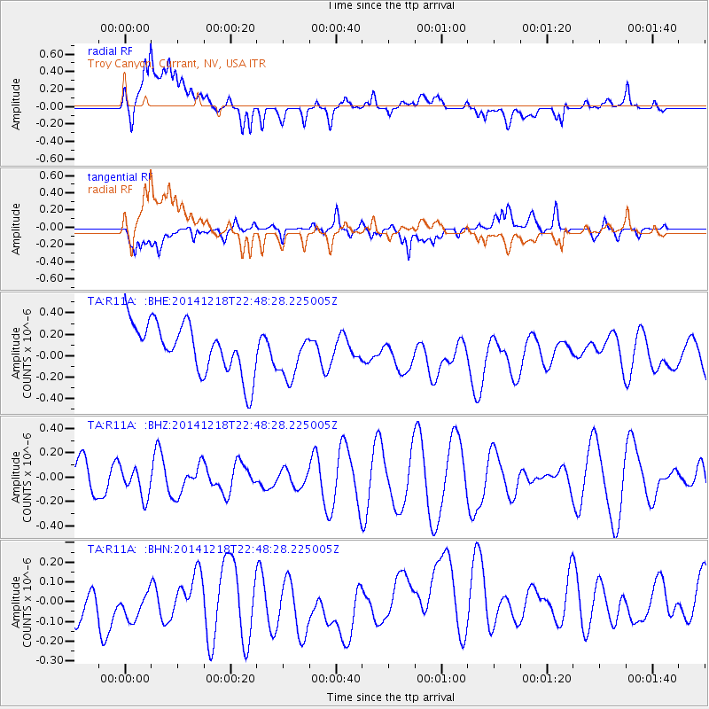
R11A Troy Canyon, Currant, NV, USA - Earthquake Result Viewer
*The percent match for this event was below the threshold and hence no stack was calculated.
| Earthquake location: |
Vanuatu Islands |
| Earthquake latitude/longitude: |
-15.0/167.0 |
| Earthquake time(UTC): |
2014/12/18 (352) 22:36:05 GMT |
| Earthquake Depth: |
36 km |
| Earthquake Magnitude: |
5.0 MW, 4.9 mb |
| Earthquake Catalog/Contributor: |
ISC/ISC |
|
| Network: |
TA USArray Transportable Network (new EarthScope stations) |
| Station: |
R11A Troy Canyon, Currant, NV, USA |
| Lat/Lon: |
38.35 N/115.59 W |
| Elevation: |
1756 m |
|
| Distance: |
89.6 deg |
| Az: |
50.118 deg |
| Baz: |
250.567 deg |
| Ray Param: |
$rayparam |
*The percent match for this event was below the threshold and hence was not used in the summary stack. |
|
| Radial Match: |
59.425755 % |
| Radial Bump: |
400 |
| Transverse Match: |
47.89886 % |
| Transverse Bump: |
400 |
| SOD ConfigId: |
3390531 |
| Insert Time: |
2019-04-15 15:06:44.678 +0000 |
| GWidth: |
2.5 |
| Max Bumps: |
400 |
| Tol: |
0.001 |
|
Signal To Noise
| Channel | StoN | STA | LTA |
| TA:R11A: :BHZ:20141218T22:48:28.225005Z | 0.61244756 | 1.2148551E-7 | 1.9836067E-7 |
| TA:R11A: :BHN:20141218T22:48:28.225005Z | 0.70054084 | 1.6012336E-7 | 2.2857107E-7 |
| TA:R11A: :BHE:20141218T22:48:28.225005Z | 0.94345367 | 2.2009964E-7 | 2.3329142E-7 |
| Arrivals |
| Ps | |
| PpPs | |
| PsPs/PpSs | |


