You are here: Home > Network List > CN - Canadian National Seismograph Network Stations List
> Station INK INUVIK, NT > Earthquake Result Viewer
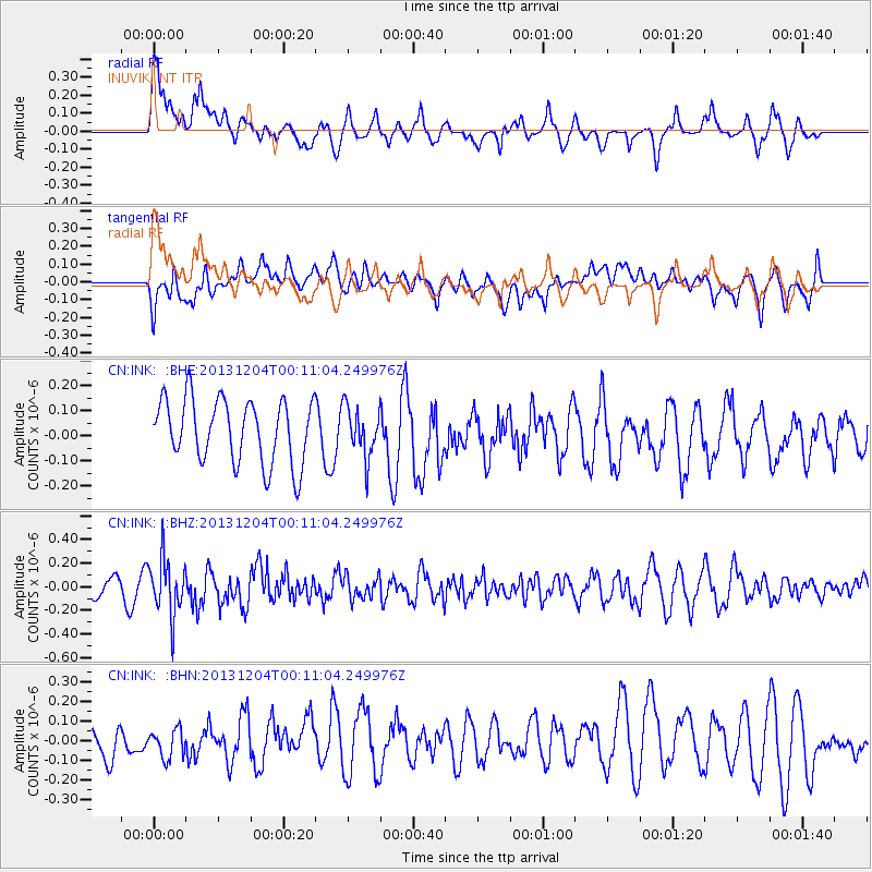
INK INUVIK, NT - Earthquake Result Viewer
*The percent match for this event was below the threshold and hence no stack was calculated.
| Earthquake location: |
Mindanao, Philippines |
| Earthquake latitude/longitude: |
6.6/126.2 |
| Earthquake time(UTC): |
2013/12/03 (337) 23:58:49 GMT |
| Earthquake Depth: |
30 km |
| Earthquake Magnitude: |
5.6 MWB, 5.6 MWC |
| Earthquake Catalog/Contributor: |
NEIC PDE/NEIC COMCAT |
|
| Network: |
CN Canadian National Seismograph Network |
| Station: |
INK INUVIK, NT |
| Lat/Lon: |
68.31 N/133.53 W |
| Elevation: |
44 m |
|
| Distance: |
87.7 deg |
| Az: |
21.475 deg |
| Baz: |
281.985 deg |
| Ray Param: |
$rayparam |
*The percent match for this event was below the threshold and hence was not used in the summary stack. |
|
| Radial Match: |
75.85118 % |
| Radial Bump: |
400 |
| Transverse Match: |
36.230255 % |
| Transverse Bump: |
400 |
| SOD ConfigId: |
626651 |
| Insert Time: |
2014-04-19 22:59:24.486 +0000 |
| GWidth: |
2.5 |
| Max Bumps: |
400 |
| Tol: |
0.001 |
|
Signal To Noise
| Channel | StoN | STA | LTA |
| CN:INK: :BHZ:20131204T00:11:04.249976Z | 2.5017014 | 2.3726362E-7 | 9.48409E-8 |
| CN:INK: :BHN:20131204T00:11:04.249976Z | 0.7261231 | 7.539684E-8 | 1.0383479E-7 |
| CN:INK: :BHE:20131204T00:11:04.249976Z | 0.7776013 | 9.844756E-8 | 1.2660415E-7 |
| Arrivals |
| Ps | |
| PpPs | |
| PsPs/PpSs | |


