You are here: Home > Network List > G - GEOSCOPE Stations List
> Station INU Inuyama, Japan > Earthquake Result Viewer
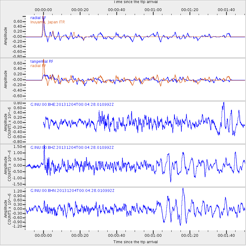
INU Inuyama, Japan - Earthquake Result Viewer
*The percent match for this event was below the threshold and hence no stack was calculated.
| Earthquake location: |
Mindanao, Philippines |
| Earthquake latitude/longitude: |
6.6/126.2 |
| Earthquake time(UTC): |
2013/12/03 (337) 23:58:49 GMT |
| Earthquake Depth: |
30 km |
| Earthquake Magnitude: |
5.6 MWB, 5.6 MWC |
| Earthquake Catalog/Contributor: |
NEIC PDE/NEIC COMCAT |
|
| Network: |
G GEOSCOPE |
| Station: |
INU Inuyama, Japan |
| Lat/Lon: |
35.35 N/137.03 E |
| Elevation: |
132 m |
|
| Distance: |
30.3 deg |
| Az: |
17.774 deg |
| Baz: |
201.776 deg |
| Ray Param: |
$rayparam |
*The percent match for this event was below the threshold and hence was not used in the summary stack. |
|
| Radial Match: |
66.72455 % |
| Radial Bump: |
390 |
| Transverse Match: |
67.555 % |
| Transverse Bump: |
400 |
| SOD ConfigId: |
626651 |
| Insert Time: |
2014-04-19 23:00:02.845 +0000 |
| GWidth: |
2.5 |
| Max Bumps: |
400 |
| Tol: |
0.001 |
|
Signal To Noise
| Channel | StoN | STA | LTA |
| G:INU:00:BHZ:20131204T00:04:28.010992Z | 4.177603 | 5.0921886E-7 | 1.218926E-7 |
| G:INU:00:BHN:20131204T00:04:28.010992Z | 1.7197067 | 2.1976895E-7 | 1.2779444E-7 |
| G:INU:00:BHE:20131204T00:04:28.010992Z | 1.9644021 | 1.988612E-7 | 1.0123243E-7 |
| Arrivals |
| Ps | |
| PpPs | |
| PsPs/PpSs | |


