You are here: Home > Network List > IU - Global Seismograph Network (GSN - IRIS/USGS) Stations List
> Station CTAO Charters Towers, Australia > Earthquake Result Viewer
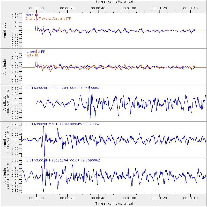
CTAO Charters Towers, Australia - Earthquake Result Viewer
*The percent match for this event was below the threshold and hence no stack was calculated.
| Earthquake location: |
Mindanao, Philippines |
| Earthquake latitude/longitude: |
6.6/126.2 |
| Earthquake time(UTC): |
2013/12/03 (337) 23:58:49 GMT |
| Earthquake Depth: |
30 km |
| Earthquake Magnitude: |
5.6 MWB, 5.6 MWC |
| Earthquake Catalog/Contributor: |
NEIC PDE/NEIC COMCAT |
|
| Network: |
IU Global Seismograph Network (GSN - IRIS/USGS) |
| Station: |
CTAO Charters Towers, Australia |
| Lat/Lon: |
20.09 S/146.25 E |
| Elevation: |
357 m |
|
| Distance: |
33.1 deg |
| Az: |
143.765 deg |
| Baz: |
321.337 deg |
| Ray Param: |
$rayparam |
*The percent match for this event was below the threshold and hence was not used in the summary stack. |
|
| Radial Match: |
74.03488 % |
| Radial Bump: |
348 |
| Transverse Match: |
48.415863 % |
| Transverse Bump: |
400 |
| SOD ConfigId: |
626651 |
| Insert Time: |
2014-04-19 23:02:49.766 +0000 |
| GWidth: |
2.5 |
| Max Bumps: |
400 |
| Tol: |
0.001 |
|
Signal To Noise
| Channel | StoN | STA | LTA |
| IU:CTAO:00:BHZ:20131204T00:04:52.569006Z | 4.7584004 | 5.2060847E-7 | 1.094083E-7 |
| IU:CTAO:00:BH1:20131204T00:04:52.569006Z | 2.358593 | 3.0867767E-7 | 1.3087366E-7 |
| IU:CTAO:00:BH2:20131204T00:04:52.569006Z | 3.4113593 | 2.7464185E-7 | 8.050804E-8 |
| Arrivals |
| Ps | |
| PpPs | |
| PsPs/PpSs | |


