You are here: Home > Network List > TJ - Tajikistan National Seismic Network Stations List
> Station GARM Garm, Tajikistan > Earthquake Result Viewer
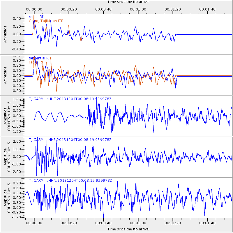
GARM Garm, Tajikistan - Earthquake Result Viewer
*The percent match for this event was below the threshold and hence no stack was calculated.
| Earthquake location: |
Mindanao, Philippines |
| Earthquake latitude/longitude: |
6.6/126.2 |
| Earthquake time(UTC): |
2013/12/03 (337) 23:58:49 GMT |
| Earthquake Depth: |
30 km |
| Earthquake Magnitude: |
5.6 MWB, 5.6 MWC |
| Earthquake Catalog/Contributor: |
NEIC PDE/NEIC COMCAT |
|
| Network: |
TJ Tajikistan National Seismic Network |
| Station: |
GARM Garm, Tajikistan |
| Lat/Lon: |
39.00 N/70.32 E |
| Elevation: |
1305 m |
|
| Distance: |
59.6 deg |
| Az: |
311.597 deg |
| Baz: |
107.558 deg |
| Ray Param: |
$rayparam |
*The percent match for this event was below the threshold and hence was not used in the summary stack. |
|
| Radial Match: |
67.77365 % |
| Radial Bump: |
400 |
| Transverse Match: |
58.637505 % |
| Transverse Bump: |
400 |
| SOD ConfigId: |
626651 |
| Insert Time: |
2014-04-19 23:06:54.650 +0000 |
| GWidth: |
2.5 |
| Max Bumps: |
400 |
| Tol: |
0.001 |
|
Signal To Noise
| Channel | StoN | STA | LTA |
| TJ:GARM: :HHZ:20131204T00:08:19.939978Z | 2.8405674 | 9.447803E-7 | 3.326027E-7 |
| TJ:GARM: :HHN:20131204T00:08:19.939978Z | 1.0074031 | 3.7639919E-7 | 3.7363313E-7 |
| TJ:GARM: :HHE:20131204T00:08:19.939978Z | 1.8145369 | 5.1085084E-7 | 2.8153235E-7 |
| Arrivals |
| Ps | |
| PpPs | |
| PsPs/PpSs | |


