You are here: Home > Network List > AZ - ANZA Regional Network Stations List
> Station SMER AZ.SMER > Earthquake Result Viewer
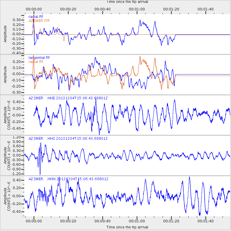
SMER AZ.SMER - Earthquake Result Viewer
*The percent match for this event was below the threshold and hence no stack was calculated.
| Earthquake location: |
South Of Fiji Islands |
| Earthquake latitude/longitude: |
-25.4/178.3 |
| Earthquake time(UTC): |
2013/12/04 (338) 14:55:40 GMT |
| Earthquake Depth: |
574 km |
| Earthquake Magnitude: |
5.7 MWW, 5.8 MWB, 5.8 MWC |
| Earthquake Catalog/Contributor: |
NEIC PDE/NEIC COMCAT |
|
| Network: |
AZ ANZA Regional Network |
| Station: |
SMER AZ.SMER |
| Lat/Lon: |
33.46 N/117.17 W |
| Elevation: |
355 m |
|
| Distance: |
84.8 deg |
| Az: |
49.298 deg |
| Baz: |
235.072 deg |
| Ray Param: |
$rayparam |
*The percent match for this event was below the threshold and hence was not used in the summary stack. |
|
| Radial Match: |
56.152607 % |
| Radial Bump: |
400 |
| Transverse Match: |
45.844822 % |
| Transverse Bump: |
400 |
| SOD ConfigId: |
626651 |
| Insert Time: |
2014-04-19 23:11:01.876 +0000 |
| GWidth: |
2.5 |
| Max Bumps: |
400 |
| Tol: |
0.001 |
|
Signal To Noise
| Channel | StoN | STA | LTA |
| AZ:SMER: :HHZ:20131204T15:06:43.66801Z | 1.8247769 | 3.832416E-7 | 2.1002107E-7 |
| AZ:SMER: :HHN:20131204T15:06:43.66801Z | 1.0172224 | 1.7162063E-7 | 1.6871493E-7 |
| AZ:SMER: :HHE:20131204T15:06:43.66801Z | 1.019115 | 1.9023449E-7 | 1.8666636E-7 |
| Arrivals |
| Ps | |
| PpPs | |
| PsPs/PpSs | |


