You are here: Home > Network List > GT - Global Telemetered Seismograph Network (USAF/USGS) Stations List
> Station PLCA Paso Flores, Argentina > Earthquake Result Viewer
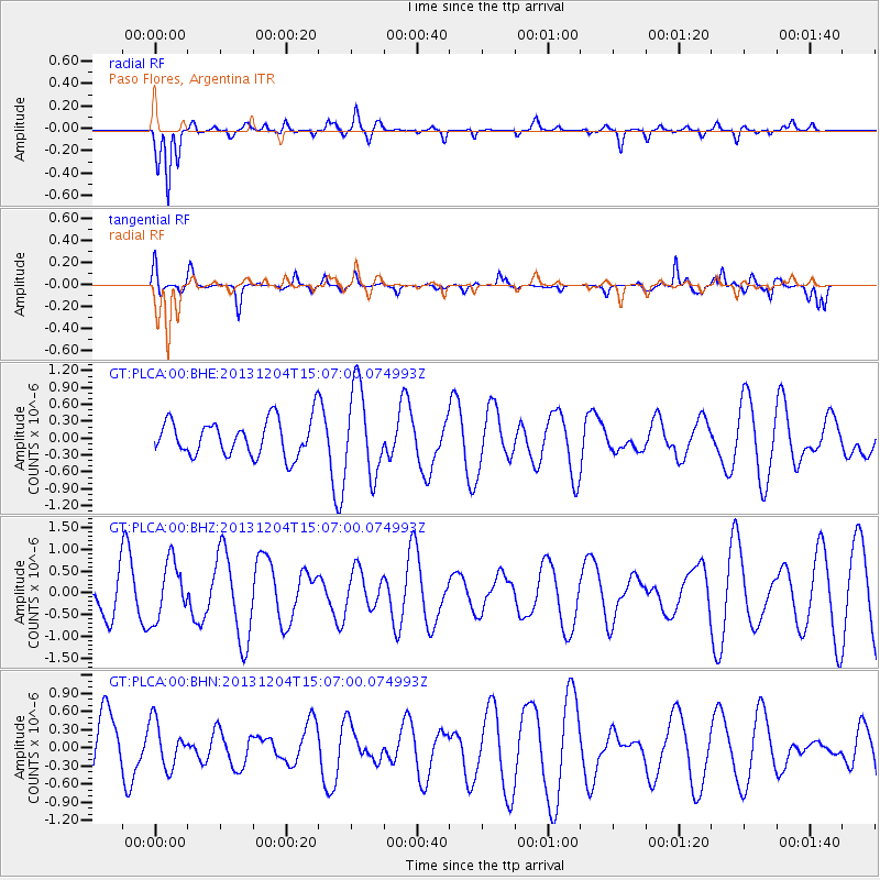
PLCA Paso Flores, Argentina - Earthquake Result Viewer
*The percent match for this event was below the threshold and hence no stack was calculated.
| Earthquake location: |
South Of Fiji Islands |
| Earthquake latitude/longitude: |
-25.4/178.3 |
| Earthquake time(UTC): |
2013/12/04 (338) 14:55:40 GMT |
| Earthquake Depth: |
574 km |
| Earthquake Magnitude: |
5.7 MWW, 5.8 MWB, 5.8 MWC |
| Earthquake Catalog/Contributor: |
NEIC PDE/NEIC COMCAT |
|
| Network: |
GT Global Telemetered Seismograph Network (USAF/USGS) |
| Station: |
PLCA Paso Flores, Argentina |
| Lat/Lon: |
40.73 S/70.55 W |
| Elevation: |
1050 m |
|
| Distance: |
88.3 deg |
| Az: |
134.861 deg |
| Baz: |
237.49 deg |
| Ray Param: |
$rayparam |
*The percent match for this event was below the threshold and hence was not used in the summary stack. |
|
| Radial Match: |
80.835556 % |
| Radial Bump: |
348 |
| Transverse Match: |
61.543816 % |
| Transverse Bump: |
285 |
| SOD ConfigId: |
626651 |
| Insert Time: |
2014-04-19 23:14:06.116 +0000 |
| GWidth: |
2.5 |
| Max Bumps: |
400 |
| Tol: |
0.001 |
|
Signal To Noise
| Channel | StoN | STA | LTA |
| GT:PLCA:00:BHZ:20131204T15:07:00.074993Z | 0.8200141 | 6.635796E-7 | 8.092295E-7 |
| GT:PLCA:00:BHN:20131204T15:07:00.074993Z | 0.5971205 | 3.7431946E-7 | 6.268742E-7 |
| GT:PLCA:00:BHE:20131204T15:07:00.074993Z | 2.4247956 | 7.7271494E-7 | 3.186722E-7 |
| Arrivals |
| Ps | |
| PpPs | |
| PsPs/PpSs | |


