You are here: Home > Network List > US - United States National Seismic Network Stations List
> Station TPNV Topopah Spring, Nevada, USA > Earthquake Result Viewer
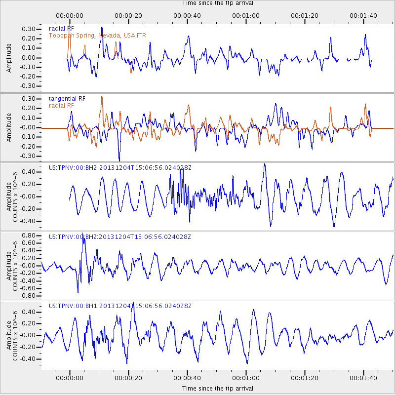
TPNV Topopah Spring, Nevada, USA - Earthquake Result Viewer
*The percent match for this event was below the threshold and hence no stack was calculated.
| Earthquake location: |
South Of Fiji Islands |
| Earthquake latitude/longitude: |
-25.4/178.3 |
| Earthquake time(UTC): |
2013/12/04 (338) 14:55:40 GMT |
| Earthquake Depth: |
574 km |
| Earthquake Magnitude: |
5.7 MWW, 5.8 MWB, 5.8 MWC |
| Earthquake Catalog/Contributor: |
NEIC PDE/NEIC COMCAT |
|
| Network: |
US United States National Seismic Network |
| Station: |
TPNV Topopah Spring, Nevada, USA |
| Lat/Lon: |
36.95 N/116.25 W |
| Elevation: |
1600 m |
|
| Distance: |
87.4 deg |
| Az: |
46.86 deg |
| Baz: |
235.437 deg |
| Ray Param: |
$rayparam |
*The percent match for this event was below the threshold and hence was not used in the summary stack. |
|
| Radial Match: |
65.5958 % |
| Radial Bump: |
400 |
| Transverse Match: |
55.514465 % |
| Transverse Bump: |
400 |
| SOD ConfigId: |
626651 |
| Insert Time: |
2014-04-19 23:21:26.212 +0000 |
| GWidth: |
2.5 |
| Max Bumps: |
400 |
| Tol: |
0.001 |
|
Signal To Noise
| Channel | StoN | STA | LTA |
| US:TPNV:00:BHZ:20131204T15:06:56.024028Z | 1.9283222 | 3.260429E-7 | 1.6908113E-7 |
| US:TPNV:00:BH1:20131204T15:06:56.024028Z | 1.8819975 | 2.4110585E-7 | 1.2811168E-7 |
| US:TPNV:00:BH2:20131204T15:06:56.024028Z | 0.81380385 | 1.4339992E-7 | 1.7620943E-7 |
| Arrivals |
| Ps | |
| PpPs | |
| PsPs/PpSs | |


