You are here: Home > Network List > AK - Alaska Regional Network Stations List
> Station MDM Murphy Dome > Earthquake Result Viewer
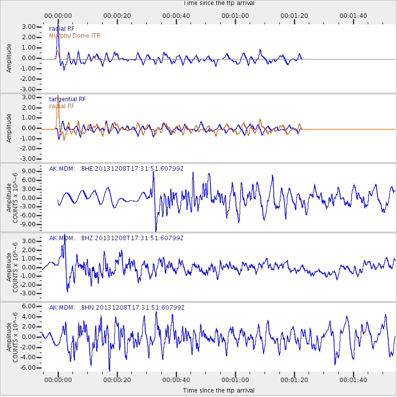
MDM Murphy Dome - Earthquake Result Viewer
*The percent match for this event was below the threshold and hence no stack was calculated.
| Earthquake location: |
Kuril Islands |
| Earthquake latitude/longitude: |
44.4/149.2 |
| Earthquake time(UTC): |
2013/12/08 (342) 17:24:54 GMT |
| Earthquake Depth: |
28 km |
| Earthquake Magnitude: |
6.0 MWW, 5.9 MWB, 6.1 MWC |
| Earthquake Catalog/Contributor: |
NEIC PDE/NEIC COMCAT |
|
| Network: |
AK Alaska Regional Network |
| Station: |
MDM Murphy Dome |
| Lat/Lon: |
64.96 N/148.23 W |
| Elevation: |
634 m |
|
| Distance: |
39.5 deg |
| Az: |
36.455 deg |
| Baz: |
269.887 deg |
| Ray Param: |
$rayparam |
*The percent match for this event was below the threshold and hence was not used in the summary stack. |
|
| Radial Match: |
75.15124 % |
| Radial Bump: |
400 |
| Transverse Match: |
55.859653 % |
| Transverse Bump: |
400 |
| SOD ConfigId: |
626651 |
| Insert Time: |
2014-04-19 23:26:36.578 +0000 |
| GWidth: |
2.5 |
| Max Bumps: |
400 |
| Tol: |
0.001 |
|
Signal To Noise
| Channel | StoN | STA | LTA |
| AK:MDM: :BHZ:20131208T17:31:51.60799Z | 2.3796675 | 1.8058515E-6 | 7.5886715E-7 |
| AK:MDM: :BHN:20131208T17:31:51.60799Z | 1.7827015 | 2.0615141E-6 | 1.156399E-6 |
| AK:MDM: :BHE:20131208T17:31:51.60799Z | 2.7526112 | 4.5686033E-6 | 1.6597344E-6 |
| Arrivals |
| Ps | |
| PpPs | |
| PsPs/PpSs | |


