You are here: Home > Network List > TA - USArray Transportable Network (new EarthScope stations) Stations List
> Station R11A Troy Canyon, Currant, NV, USA > Earthquake Result Viewer
R11A Troy Canyon, Currant, NV, USA - Earthquake Result Viewer
*The percent match for this event was below the threshold and hence no stack was calculated.
| Earthquake location: |
Central Italy |
| Earthquake latitude/longitude: |
43.6/11.2 |
| Earthquake time(UTC): |
2014/12/19 (353) 09:39:41 GMT |
| Earthquake Depth: |
8.9 km |
| Earthquake Magnitude: |
3.8 Mw, 3.8 ML |
| Earthquake Catalog/Contributor: |
ISC/ISC |
|
| Network: |
TA USArray Transportable Network (new EarthScope stations) |
| Station: |
R11A Troy Canyon, Currant, NV, USA |
| Lat/Lon: |
38.35 N/115.59 W |
| Elevation: |
1756 m |
|
| Distance: |
85.3 deg |
| Az: |
320.838 deg |
| Baz: |
35.695 deg |
| Ray Param: |
$rayparam |
*The percent match for this event was below the threshold and hence was not used in the summary stack. |
|
| Radial Match: |
70.430725 % |
| Radial Bump: |
400 |
| Transverse Match: |
86.049576 % |
| Transverse Bump: |
394 |
| SOD ConfigId: |
3390531 |
| Insert Time: |
2019-04-15 15:29:06.897 +0000 |
| GWidth: |
2.5 |
| Max Bumps: |
400 |
| Tol: |
0.001 |
|
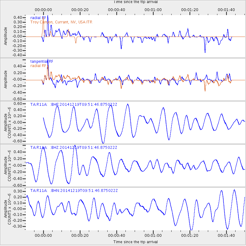
Signal To Noise
| Channel | StoN | STA | LTA |
| TA:R11A: :BHZ:20141219T09:51:46.875022Z | 1.1155727 | 4.2466596E-7 | 3.8067083E-7 |
| TA:R11A: :BHN:20141219T09:51:46.875022Z | 1.0871323 | 1.5058967E-7 | 1.385201E-7 |
| TA:R11A: :BHE:20141219T09:51:46.875022Z | 1.4432051 | 4.0405092E-7 | 2.799678E-7 |
| Arrivals |
| Ps | |
| PpPs | |
| PsPs/PpSs | |


