You are here: Home > Network List > IW - Intermountain West Stations List
> Station MOOW Moose Ponds, Wyoming, USA > Earthquake Result Viewer
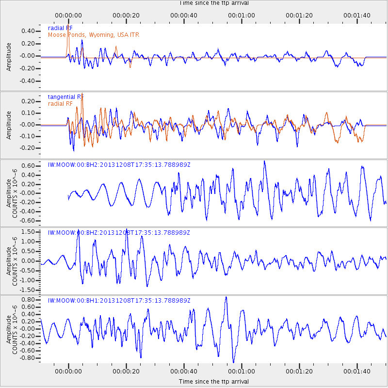
MOOW Moose Ponds, Wyoming, USA - Earthquake Result Viewer
*The percent match for this event was below the threshold and hence no stack was calculated.
| Earthquake location: |
Kuril Islands |
| Earthquake latitude/longitude: |
44.4/149.2 |
| Earthquake time(UTC): |
2013/12/08 (342) 17:24:54 GMT |
| Earthquake Depth: |
28 km |
| Earthquake Magnitude: |
6.0 MWW, 5.9 MWB, 6.1 MWC |
| Earthquake Catalog/Contributor: |
NEIC PDE/NEIC COMCAT |
|
| Network: |
IW Intermountain West |
| Station: |
MOOW Moose Ponds, Wyoming, USA |
| Lat/Lon: |
43.75 N/110.74 W |
| Elevation: |
2128 m |
|
| Distance: |
67.1 deg |
| Az: |
50.788 deg |
| Baz: |
310.02 deg |
| Ray Param: |
$rayparam |
*The percent match for this event was below the threshold and hence was not used in the summary stack. |
|
| Radial Match: |
57.97023 % |
| Radial Bump: |
400 |
| Transverse Match: |
72.745735 % |
| Transverse Bump: |
400 |
| SOD ConfigId: |
626651 |
| Insert Time: |
2014-04-19 23:42:23.473 +0000 |
| GWidth: |
2.5 |
| Max Bumps: |
400 |
| Tol: |
0.001 |
|
Signal To Noise
| Channel | StoN | STA | LTA |
| IW:MOOW:00:BHZ:20131208T17:35:13.788989Z | 3.8619196 | 6.608436E-7 | 1.711179E-7 |
| IW:MOOW:00:BH1:20131208T17:35:13.788989Z | 0.8552493 | 2.1698575E-7 | 2.5371054E-7 |
| IW:MOOW:00:BH2:20131208T17:35:13.788989Z | 1.475601 | 2.1649643E-7 | 1.4671747E-7 |
| Arrivals |
| Ps | |
| PpPs | |
| PsPs/PpSs | |


