You are here: Home > Network List > TA - USArray Transportable Network (new EarthScope stations) Stations List
> Station G03D McMinnville, OR, USA > Earthquake Result Viewer
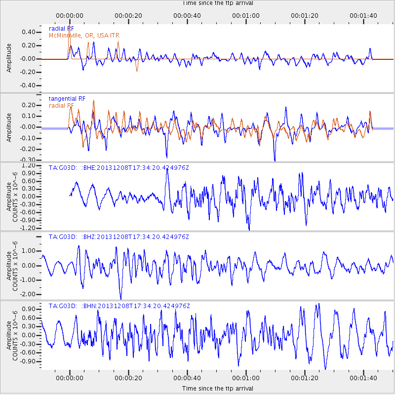
G03D McMinnville, OR, USA - Earthquake Result Viewer
*The percent match for this event was below the threshold and hence no stack was calculated.
| Earthquake location: |
Kuril Islands |
| Earthquake latitude/longitude: |
44.4/149.2 |
| Earthquake time(UTC): |
2013/12/08 (342) 17:24:54 GMT |
| Earthquake Depth: |
28 km |
| Earthquake Magnitude: |
6.0 MWW, 5.9 MWB, 6.1 MWC |
| Earthquake Catalog/Contributor: |
NEIC PDE/NEIC COMCAT |
|
| Network: |
TA USArray Transportable Network (new EarthScope stations) |
| Station: |
G03D McMinnville, OR, USA |
| Lat/Lon: |
45.21 N/123.26 W |
| Elevation: |
222 m |
|
| Distance: |
59.0 deg |
| Az: |
55.48 deg |
| Baz: |
303.394 deg |
| Ray Param: |
$rayparam |
*The percent match for this event was below the threshold and hence was not used in the summary stack. |
|
| Radial Match: |
62.249344 % |
| Radial Bump: |
400 |
| Transverse Match: |
67.84133 % |
| Transverse Bump: |
400 |
| SOD ConfigId: |
626651 |
| Insert Time: |
2014-04-19 23:54:29.291 +0000 |
| GWidth: |
2.5 |
| Max Bumps: |
400 |
| Tol: |
0.001 |
|
Signal To Noise
| Channel | StoN | STA | LTA |
| TA:G03D: :BHZ:20131208T17:34:20.424976Z | 2.2608309 | 7.5849005E-7 | 3.3549173E-7 |
| TA:G03D: :BHN:20131208T17:34:20.424976Z | 1.0575054 | 3.2248005E-7 | 3.049441E-7 |
| TA:G03D: :BHE:20131208T17:34:20.424976Z | 1.9492166 | 4.4748253E-7 | 2.2957046E-7 |
| Arrivals |
| Ps | |
| PpPs | |
| PsPs/PpSs | |


