You are here: Home > Network List > TA - USArray Transportable Network (new EarthScope stations) Stations List
> Station MSTX Muleshoe, TX, USA > Earthquake Result Viewer
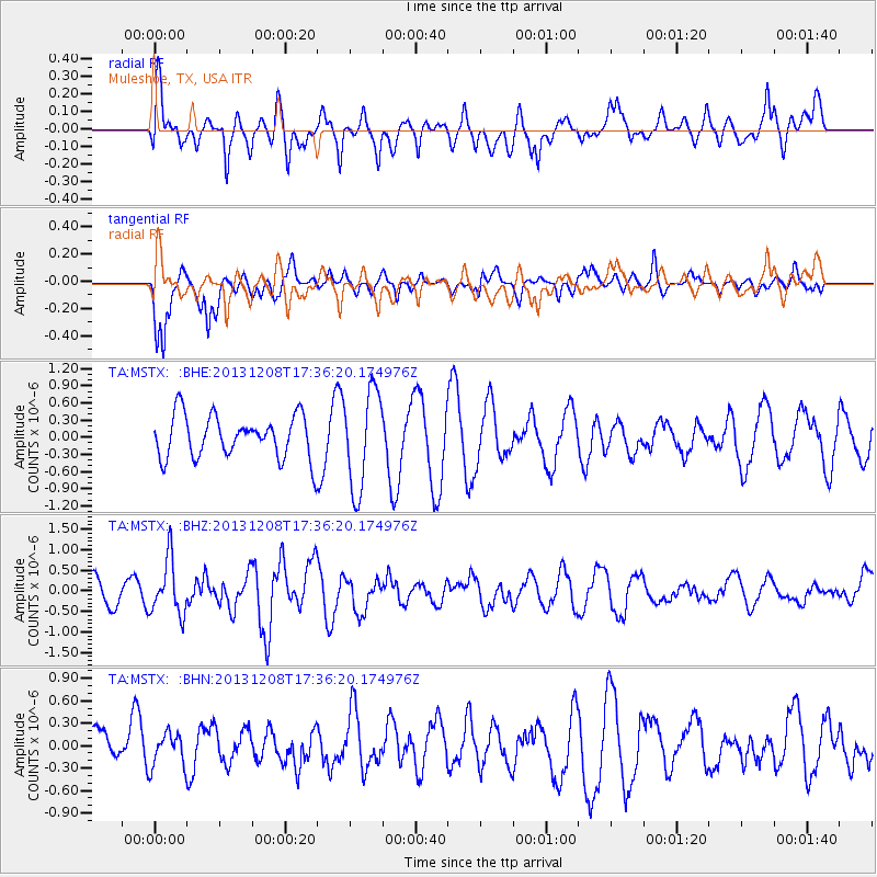
MSTX Muleshoe, TX, USA - Earthquake Result Viewer
*The percent match for this event was below the threshold and hence no stack was calculated.
| Earthquake location: |
Kuril Islands |
| Earthquake latitude/longitude: |
44.4/149.2 |
| Earthquake time(UTC): |
2013/12/08 (342) 17:24:54 GMT |
| Earthquake Depth: |
28 km |
| Earthquake Magnitude: |
6.0 MWW, 5.9 MWB, 6.1 MWC |
| Earthquake Catalog/Contributor: |
NEIC PDE/NEIC COMCAT |
|
| Network: |
TA USArray Transportable Network (new EarthScope stations) |
| Station: |
MSTX Muleshoe, TX, USA |
| Lat/Lon: |
33.97 N/102.77 W |
| Elevation: |
1167 m |
|
| Distance: |
78.3 deg |
| Az: |
53.805 deg |
| Baz: |
315.929 deg |
| Ray Param: |
$rayparam |
*The percent match for this event was below the threshold and hence was not used in the summary stack. |
|
| Radial Match: |
65.05854 % |
| Radial Bump: |
400 |
| Transverse Match: |
78.03122 % |
| Transverse Bump: |
400 |
| SOD ConfigId: |
626651 |
| Insert Time: |
2014-04-19 23:59:36.909 +0000 |
| GWidth: |
2.5 |
| Max Bumps: |
400 |
| Tol: |
0.001 |
|
Signal To Noise
| Channel | StoN | STA | LTA |
| TA:MSTX: :BHZ:20131208T17:36:20.174976Z | 2.1705425 | 6.740949E-7 | 3.1056518E-7 |
| TA:MSTX: :BHN:20131208T17:36:20.174976Z | 0.6838912 | 2.2823936E-7 | 3.3373638E-7 |
| TA:MSTX: :BHE:20131208T17:36:20.174976Z | 2.311412 | 8.5897904E-7 | 3.7162522E-7 |
| Arrivals |
| Ps | |
| PpPs | |
| PsPs/PpSs | |


