You are here: Home > Network List > US - United States National Seismic Network Stations List
> Station BOZ Bozeman, Montana, USA > Earthquake Result Viewer
BOZ Bozeman, Montana, USA - Earthquake Result Viewer
*The percent match for this event was below the threshold and hence no stack was calculated.
| Earthquake location: |
Kuril Islands |
| Earthquake latitude/longitude: |
44.4/149.2 |
| Earthquake time(UTC): |
2013/12/08 (342) 17:24:54 GMT |
| Earthquake Depth: |
28 km |
| Earthquake Magnitude: |
6.0 MWW, 5.9 MWB, 6.1 MWC |
| Earthquake Catalog/Contributor: |
NEIC PDE/NEIC COMCAT |
|
| Network: |
US United States National Seismic Network |
| Station: |
BOZ Bozeman, Montana, USA |
| Lat/Lon: |
45.65 N/111.63 W |
| Elevation: |
1589 m |
|
| Distance: |
65.4 deg |
| Az: |
49.626 deg |
| Baz: |
308.93 deg |
| Ray Param: |
$rayparam |
*The percent match for this event was below the threshold and hence was not used in the summary stack. |
|
| Radial Match: |
47.701794 % |
| Radial Bump: |
400 |
| Transverse Match: |
66.835266 % |
| Transverse Bump: |
400 |
| SOD ConfigId: |
626651 |
| Insert Time: |
2014-04-20 00:07:05.235 +0000 |
| GWidth: |
2.5 |
| Max Bumps: |
400 |
| Tol: |
0.001 |
|
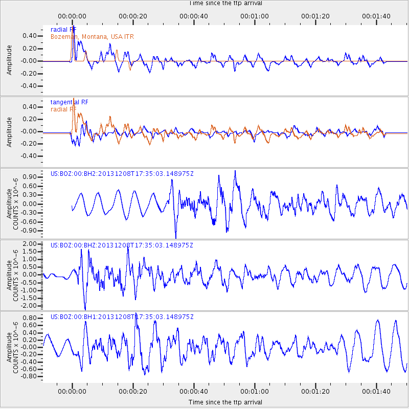
Signal To Noise
| Channel | StoN | STA | LTA |
| US:BOZ:00:BHZ:20131208T17:35:03.148975Z | 7.435297 | 8.866524E-7 | 1.192491E-7 |
| US:BOZ:00:BH1:20131208T17:35:03.148975Z | 1.4742762 | 3.5300084E-7 | 2.394401E-7 |
| US:BOZ:00:BH2:20131208T17:35:03.148975Z | 1.5921997 | 4.4622087E-7 | 2.8025434E-7 |
| Arrivals |
| Ps | |
| PpPs | |
| PsPs/PpSs | |


