You are here: Home > Network List > US - United States National Seismic Network Stations List
> Station MSO Missoula, Montana, USA > Earthquake Result Viewer
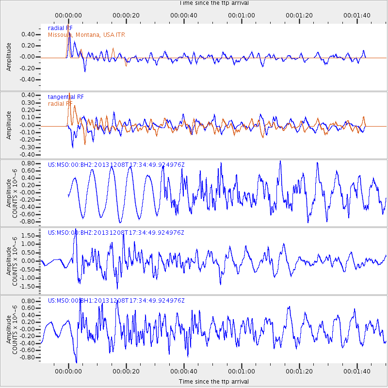
MSO Missoula, Montana, USA - Earthquake Result Viewer
*The percent match for this event was below the threshold and hence no stack was calculated.
| Earthquake location: |
Kuril Islands |
| Earthquake latitude/longitude: |
44.4/149.2 |
| Earthquake time(UTC): |
2013/12/08 (342) 17:24:54 GMT |
| Earthquake Depth: |
28 km |
| Earthquake Magnitude: |
6.0 MWW, 5.9 MWB, 6.1 MWC |
| Earthquake Catalog/Contributor: |
NEIC PDE/NEIC COMCAT |
|
| Network: |
US United States National Seismic Network |
| Station: |
MSO Missoula, Montana, USA |
| Lat/Lon: |
46.83 N/113.94 W |
| Elevation: |
1264 m |
|
| Distance: |
63.4 deg |
| Az: |
49.692 deg |
| Baz: |
307.295 deg |
| Ray Param: |
$rayparam |
*The percent match for this event was below the threshold and hence was not used in the summary stack. |
|
| Radial Match: |
39.450462 % |
| Radial Bump: |
400 |
| Transverse Match: |
64.16126 % |
| Transverse Bump: |
400 |
| SOD ConfigId: |
626651 |
| Insert Time: |
2014-04-20 00:08:18.919 +0000 |
| GWidth: |
2.5 |
| Max Bumps: |
400 |
| Tol: |
0.001 |
|
Signal To Noise
| Channel | StoN | STA | LTA |
| US:MSO:00:BHZ:20131208T17:34:49.924976Z | 3.250728 | 8.606089E-7 | 2.6474345E-7 |
| US:MSO:00:BH1:20131208T17:34:49.924976Z | 2.229407 | 4.5256766E-7 | 2.029991E-7 |
| US:MSO:00:BH2:20131208T17:34:49.924976Z | 0.8570143 | 4.0994445E-7 | 4.7834027E-7 |
| Arrivals |
| Ps | |
| PpPs | |
| PsPs/PpSs | |


