You are here: Home > Network List > UU - University of Utah Regional Network Stations List
> Station KNB Kanab, UT, USA > Earthquake Result Viewer
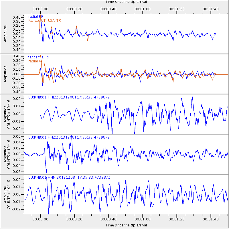
KNB Kanab, UT, USA - Earthquake Result Viewer
*The percent match for this event was below the threshold and hence no stack was calculated.
| Earthquake location: |
Kuril Islands |
| Earthquake latitude/longitude: |
44.4/149.2 |
| Earthquake time(UTC): |
2013/12/08 (342) 17:24:54 GMT |
| Earthquake Depth: |
28 km |
| Earthquake Magnitude: |
6.0 MWW, 5.9 MWB, 6.1 MWC |
| Earthquake Catalog/Contributor: |
NEIC PDE/NEIC COMCAT |
|
| Network: |
UU University of Utah Regional Network |
| Station: |
KNB Kanab, UT, USA |
| Lat/Lon: |
37.02 N/112.82 W |
| Elevation: |
1715 m |
|
| Distance: |
70.2 deg |
| Az: |
57.382 deg |
| Baz: |
311.082 deg |
| Ray Param: |
$rayparam |
*The percent match for this event was below the threshold and hence was not used in the summary stack. |
|
| Radial Match: |
75.62064 % |
| Radial Bump: |
378 |
| Transverse Match: |
82.477936 % |
| Transverse Bump: |
400 |
| SOD ConfigId: |
626651 |
| Insert Time: |
2014-04-20 00:09:17.906 +0000 |
| GWidth: |
2.5 |
| Max Bumps: |
400 |
| Tol: |
0.001 |
|
Signal To Noise
| Channel | StoN | STA | LTA |
| UU:KNB:01:HHZ:20131208T17:35:33.473987Z | 5.245671 | 2.3398822E-8 | 4.460597E-9 |
| UU:KNB:01:HHN:20131208T17:35:33.473987Z | 2.3563132 | 1.0270698E-8 | 4.3588E-9 |
| UU:KNB:01:HHE:20131208T17:35:33.473987Z | 1.0811806 | 5.3199782E-9 | 4.920527E-9 |
| Arrivals |
| Ps | |
| PpPs | |
| PsPs/PpSs | |


