You are here: Home > Network List > UW - Pacific Northwest Regional Seismic Network Stations List
> Station LEBA Lebam, WA, USA > Earthquake Result Viewer
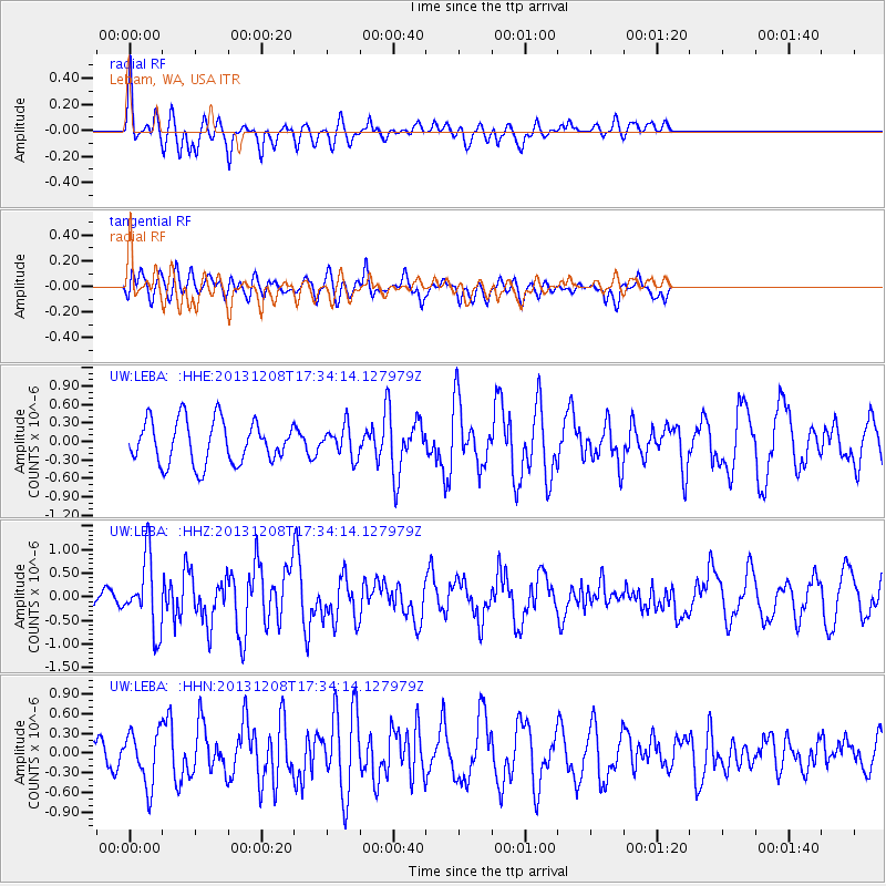
LEBA Lebam, WA, USA - Earthquake Result Viewer
*The percent match for this event was below the threshold and hence no stack was calculated.
| Earthquake location: |
Kuril Islands |
| Earthquake latitude/longitude: |
44.4/149.2 |
| Earthquake time(UTC): |
2013/12/08 (342) 17:24:54 GMT |
| Earthquake Depth: |
28 km |
| Earthquake Magnitude: |
6.0 MWW, 5.9 MWB, 6.1 MWC |
| Earthquake Catalog/Contributor: |
NEIC PDE/NEIC COMCAT |
|
| Network: |
UW Pacific Northwest Regional Seismic Network |
| Station: |
LEBA Lebam, WA, USA |
| Lat/Lon: |
46.55 N/123.56 W |
| Elevation: |
73 m |
|
| Distance: |
58.1 deg |
| Az: |
54.301 deg |
| Baz: |
302.565 deg |
| Ray Param: |
$rayparam |
*The percent match for this event was below the threshold and hence was not used in the summary stack. |
|
| Radial Match: |
65.87855 % |
| Radial Bump: |
400 |
| Transverse Match: |
54.838573 % |
| Transverse Bump: |
400 |
| SOD ConfigId: |
626651 |
| Insert Time: |
2014-04-20 00:10:35.588 +0000 |
| GWidth: |
2.5 |
| Max Bumps: |
400 |
| Tol: |
0.001 |
|
Signal To Noise
| Channel | StoN | STA | LTA |
| UW:LEBA: :HHZ:20131208T17:34:14.127979Z | 3.3913555 | 7.478309E-7 | 2.205109E-7 |
| UW:LEBA: :HHN:20131208T17:34:14.127979Z | 1.2791246 | 4.0492728E-7 | 3.1656595E-7 |
| UW:LEBA: :HHE:20131208T17:34:14.127979Z | 0.72210896 | 2.4893808E-7 | 3.4473754E-7 |
| Arrivals |
| Ps | |
| PpPs | |
| PsPs/PpSs | |


