You are here: Home > Network List > TA - USArray Transportable Network (new EarthScope stations) Stations List
> Station J61A Chester, VT, USA > Earthquake Result Viewer
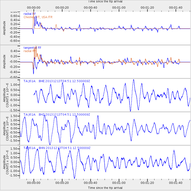
J61A Chester, VT, USA - Earthquake Result Viewer
*The percent match for this event was below the threshold and hence no stack was calculated.
| Earthquake location: |
El Salvador |
| Earthquake latitude/longitude: |
13.1/-89.1 |
| Earthquake time(UTC): |
2013/12/13 (347) 04:45:11 GMT |
| Earthquake Depth: |
68 km |
| Earthquake Magnitude: |
5.6 MWB, 5.5 MWC |
| Earthquake Catalog/Contributor: |
NEIC PDE/NEIC COMCAT |
|
| Network: |
TA USArray Transportable Network (new EarthScope stations) |
| Station: |
J61A Chester, VT, USA |
| Lat/Lon: |
43.35 N/72.55 W |
| Elevation: |
253 m |
|
| Distance: |
33.3 deg |
| Az: |
22.215 deg |
| Baz: |
210.324 deg |
| Ray Param: |
$rayparam |
*The percent match for this event was below the threshold and hence was not used in the summary stack. |
|
| Radial Match: |
72.12799 % |
| Radial Bump: |
400 |
| Transverse Match: |
62.034985 % |
| Transverse Bump: |
400 |
| SOD ConfigId: |
626651 |
| Insert Time: |
2014-04-20 00:28:38.827 +0000 |
| GWidth: |
2.5 |
| Max Bumps: |
400 |
| Tol: |
0.001 |
|
Signal To Noise
| Channel | StoN | STA | LTA |
| TA:J61A: :BHZ:20131213T04:51:12.500009Z | 0.82557327 | 7.681711E-7 | 9.304699E-7 |
| TA:J61A: :BHN:20131213T04:51:12.500009Z | 1.7418455 | 9.373532E-7 | 5.3813795E-7 |
| TA:J61A: :BHE:20131213T04:51:12.500009Z | 1.2572088 | 6.169388E-7 | 4.9072105E-7 |
| Arrivals |
| Ps | |
| PpPs | |
| PsPs/PpSs | |


