You are here: Home > Network List > UW - Pacific Northwest Regional Seismic Network Stations List
> Station MRBL Marblemount, WA, USA > Earthquake Result Viewer
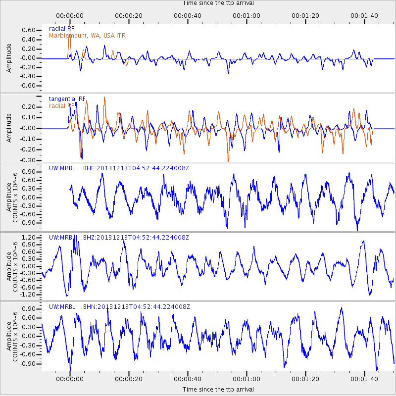
MRBL Marblemount, WA, USA - Earthquake Result Viewer
*The percent match for this event was below the threshold and hence no stack was calculated.
| Earthquake location: |
El Salvador |
| Earthquake latitude/longitude: |
13.1/-89.1 |
| Earthquake time(UTC): |
2013/12/13 (347) 04:45:11 GMT |
| Earthquake Depth: |
68 km |
| Earthquake Magnitude: |
5.6 MWB, 5.5 MWC |
| Earthquake Catalog/Contributor: |
NEIC PDE/NEIC COMCAT |
|
| Network: |
UW Pacific Northwest Regional Seismic Network |
| Station: |
MRBL Marblemount, WA, USA |
| Lat/Lon: |
48.52 N/121.48 W |
| Elevation: |
75 m |
|
| Distance: |
44.3 deg |
| Az: |
329.342 deg |
| Baz: |
131.657 deg |
| Ray Param: |
$rayparam |
*The percent match for this event was below the threshold and hence was not used in the summary stack. |
|
| Radial Match: |
76.7799 % |
| Radial Bump: |
400 |
| Transverse Match: |
70.00709 % |
| Transverse Bump: |
400 |
| SOD ConfigId: |
626651 |
| Insert Time: |
2014-04-20 00:31:33.125 +0000 |
| GWidth: |
2.5 |
| Max Bumps: |
400 |
| Tol: |
0.001 |
|
Signal To Noise
| Channel | StoN | STA | LTA |
| UW:MRBL: :BHZ:20131213T04:52:44.224008Z | 3.8247325 | 7.99335E-7 | 2.0899108E-7 |
| UW:MRBL: :BHN:20131213T04:52:44.224008Z | 2.6394193 | 5.9895166E-7 | 2.2692555E-7 |
| UW:MRBL: :BHE:20131213T04:52:44.224008Z | 1.0765254 | 3.8929E-7 | 3.616171E-7 |
| Arrivals |
| Ps | |
| PpPs | |
| PsPs/PpSs | |


