You are here: Home > Network List > TA - USArray Transportable Network (new EarthScope stations) Stations List
> Station W41B Gary Mavity, Velonia, AR, USA > Earthquake Result Viewer
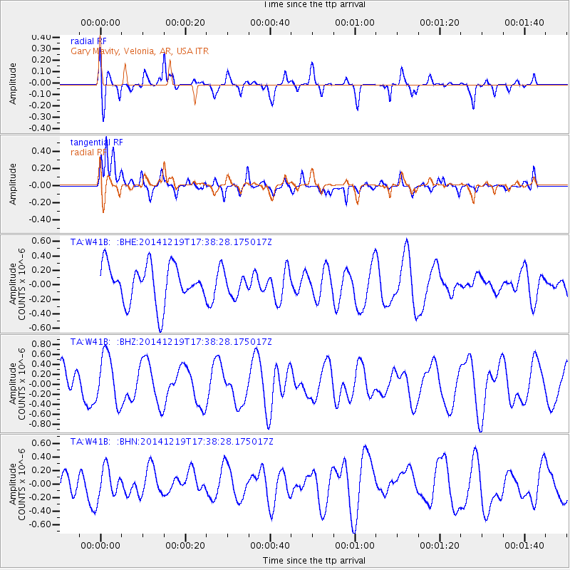
W41B Gary Mavity, Velonia, AR, USA - Earthquake Result Viewer
*The percent match for this event was below the threshold and hence no stack was calculated.
| Earthquake location: |
Central Italy |
| Earthquake latitude/longitude: |
43.6/11.2 |
| Earthquake time(UTC): |
2014/12/19 (353) 17:27:16 GMT |
| Earthquake Depth: |
7.3 km |
| Earthquake Magnitude: |
3.6 mb, 3.6 ML |
| Earthquake Catalog/Contributor: |
ISC/ISC |
|
| Network: |
TA USArray Transportable Network (new EarthScope stations) |
| Station: |
W41B Gary Mavity, Velonia, AR, USA |
| Lat/Lon: |
35.17 N/92.25 W |
| Elevation: |
95 m |
|
| Distance: |
75.2 deg |
| Az: |
304.51 deg |
| Baz: |
46.924 deg |
| Ray Param: |
$rayparam |
*The percent match for this event was below the threshold and hence was not used in the summary stack. |
|
| Radial Match: |
61.90515 % |
| Radial Bump: |
400 |
| Transverse Match: |
73.66 % |
| Transverse Bump: |
400 |
| SOD ConfigId: |
3390531 |
| Insert Time: |
2019-04-15 15:59:26.117 +0000 |
| GWidth: |
2.5 |
| Max Bumps: |
400 |
| Tol: |
0.001 |
|
Signal To Noise
| Channel | StoN | STA | LTA |
| TA:W41B: :BHZ:20141219T17:38:28.175017Z | 1.7726822 | 5.0574033E-7 | 2.8529666E-7 |
| TA:W41B: :BHN:20141219T17:38:28.175017Z | 1.0894357 | 2.2944269E-7 | 2.1060691E-7 |
| TA:W41B: :BHE:20141219T17:38:28.175017Z | 0.55028385 | 1.443437E-7 | 2.623077E-7 |
| Arrivals |
| Ps | |
| PpPs | |
| PsPs/PpSs | |


