You are here: Home > Network List > IU - Global Seismograph Network (GSN - IRIS/USGS) Stations List
> Station PMG Port Moresby, New Guinea > Earthquake Result Viewer
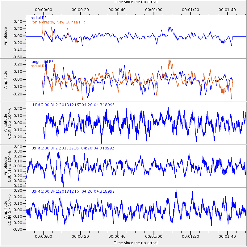
PMG Port Moresby, New Guinea - Earthquake Result Viewer
*The percent match for this event was below the threshold and hence no stack was calculated.
| Earthquake location: |
West Of Macquarie Island |
| Earthquake latitude/longitude: |
-58.7/149.3 |
| Earthquake time(UTC): |
2013/12/16 (350) 04:11:46 GMT |
| Earthquake Depth: |
6.7 km |
| Earthquake Magnitude: |
5.5 MWB, 5.6 MWC |
| Earthquake Catalog/Contributor: |
NEIC PDE/NEIC COMCAT |
|
| Network: |
IU Global Seismograph Network (GSN - IRIS/USGS) |
| Station: |
PMG Port Moresby, New Guinea |
| Lat/Lon: |
9.40 S/147.16 E |
| Elevation: |
90 m |
|
| Distance: |
49.2 deg |
| Az: |
357.15 deg |
| Baz: |
178.492 deg |
| Ray Param: |
$rayparam |
*The percent match for this event was below the threshold and hence was not used in the summary stack. |
|
| Radial Match: |
59.070286 % |
| Radial Bump: |
400 |
| Transverse Match: |
55.70252 % |
| Transverse Bump: |
400 |
| SOD ConfigId: |
626651 |
| Insert Time: |
2014-04-20 01:02:46.574 +0000 |
| GWidth: |
2.5 |
| Max Bumps: |
400 |
| Tol: |
0.001 |
|
Signal To Noise
| Channel | StoN | STA | LTA |
| IU:PMG:00:BHZ:20131216T04:20:04.31899Z | 1.6928687 | 1.4254296E-7 | 8.420202E-8 |
| IU:PMG:00:BH1:20131216T04:20:04.31899Z | 1.2161924 | 8.3004636E-8 | 6.824959E-8 |
| IU:PMG:00:BH2:20131216T04:20:04.31899Z | 1.3503364 | 1.050968E-7 | 7.7830094E-8 |
| Arrivals |
| Ps | |
| PpPs | |
| PsPs/PpSs | |


