KIV Kislovodsk, Russia - Earthquake Result Viewer
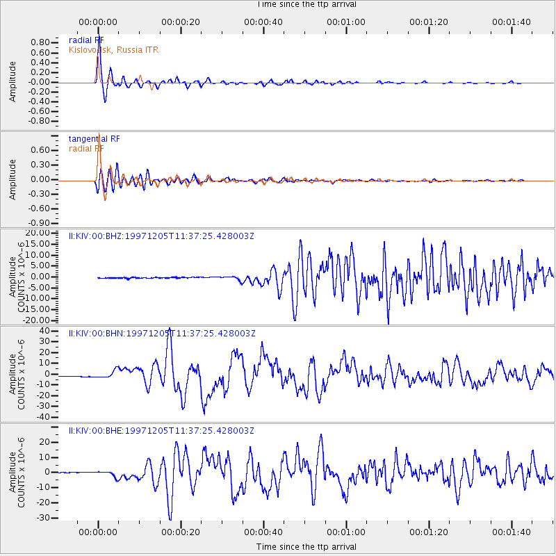
Earthquake location: Near East Coast Of Kamchatka
Earthquake latitude/longitude: 54.8/162.0
Earthquake time(UTC): 1997/12/05 (339) 11:26:54 GMT
Earthquake Depth: 33 km
Earthquake Magnitude: 6.3 MB, 7.6 MS, 7.9 UNKNOWN, 7.3 ME
Earthquake Catalog/Contributor: WHDF/NEIC
Network: II Global Seismograph Network (GSN - IRIS/IDA)
Station: KIV Kislovodsk, Russia
Lat/Lon: 43.96 N/42.69 E
Elevation: 1054 m
Distance: 68.9 deg
Az: 317.576 deg
Baz: 32.705 deg
Ray Param: 0.055930164
Estimated Moho Depth: 43.25 km
Estimated Crust Vp/Vs: 1.85
Assumed Crust Vp: 6.247 km/s
Estimated Crust Vs: 3.381 km/s
Estimated Crust Poisson's Ratio: 0.29
Radial Match: 98.36173 %
Radial Bump: 257
Transverse Match: 86.01515 %
Transverse Bump: 400
SOD ConfigId: 4480
Insert Time: 2010-03-01 18:13:10.803 +0000
GWidth: 2.5
Max Bumps: 400
Tol: 0.001

Signal To Noise

ChannelStoNSTALTA
II:KIV:00:BHN:19971205T11:37:25.428003Z8.816693.6554757E-64.146086E-7
II:KIV:00:BHE:19971205T11:37:25.428003Z8.7050751.9937374E-62.2903161E-7
II:KIV:00:BHZ:19971205T11:37:25.428003Z4.5082099.2079233E-72.0424791E-7
Arrivals
Ps6.1 SECOND
PpPs19 SECOND
PsPs/PpSs25 SECOND