You are here: Home > Network List > TA - USArray Transportable Network (new EarthScope stations) Stations List
> Station Z41A Richland Creek Farm, El Dorado, AR, USA > Earthquake Result Viewer
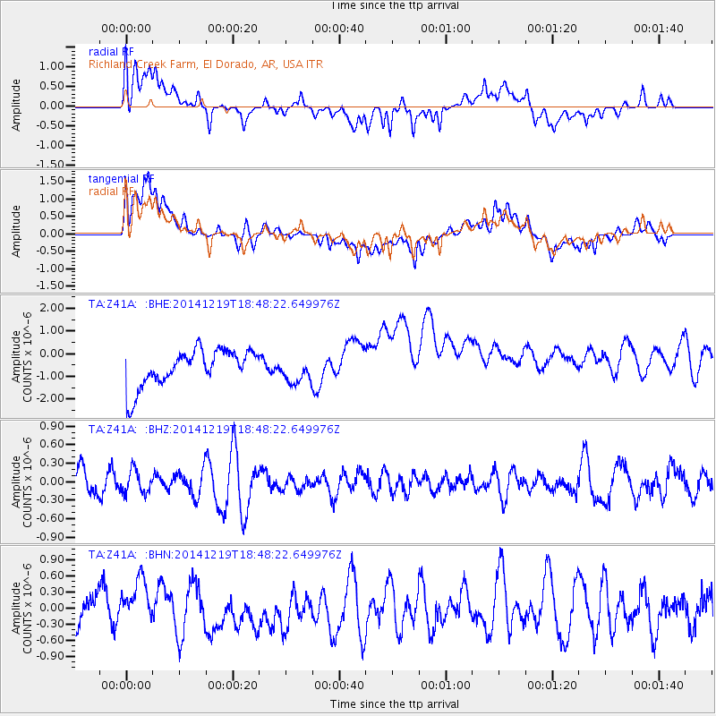
Z41A Richland Creek Farm, El Dorado, AR, USA - Earthquake Result Viewer
*The percent match for this event was below the threshold and hence no stack was calculated.
| Earthquake location: |
Central Italy |
| Earthquake latitude/longitude: |
43.6/11.2 |
| Earthquake time(UTC): |
2014/12/19 (353) 18:37:01 GMT |
| Earthquake Depth: |
8.3 km |
| Earthquake Magnitude: |
3.8 mb, 3.5 ML |
| Earthquake Catalog/Contributor: |
ISC/ISC |
|
| Network: |
TA USArray Transportable Network (new EarthScope stations) |
| Station: |
Z41A Richland Creek Farm, El Dorado, AR, USA |
| Lat/Lon: |
33.26 N/92.80 W |
| Elevation: |
62 m |
|
| Distance: |
76.8 deg |
| Az: |
303.388 deg |
| Baz: |
46.371 deg |
| Ray Param: |
$rayparam |
*The percent match for this event was below the threshold and hence was not used in the summary stack. |
|
| Radial Match: |
55.92798 % |
| Radial Bump: |
400 |
| Transverse Match: |
49.056046 % |
| Transverse Bump: |
400 |
| SOD ConfigId: |
3390531 |
| Insert Time: |
2019-04-15 16:11:22.710 +0000 |
| GWidth: |
2.5 |
| Max Bumps: |
400 |
| Tol: |
0.001 |
|
Signal To Noise
| Channel | StoN | STA | LTA |
| TA:Z41A: :BHZ:20141219T18:48:22.649976Z | 0.69540685 | 1.8777494E-7 | 2.7002173E-7 |
| TA:Z41A: :BHN:20141219T18:48:22.649976Z | 0.7386945 | 3.5175793E-7 | 4.7618866E-7 |
| TA:Z41A: :BHE:20141219T18:48:22.649976Z | 0.69792545 | 5.6165413E-7 | 8.04748E-7 |
| Arrivals |
| Ps | |
| PpPs | |
| PsPs/PpSs | |


