You are here: Home > Network List > AK - Alaska Regional Network Stations List
> Station GAMB Gambell Broadband > Earthquake Result Viewer
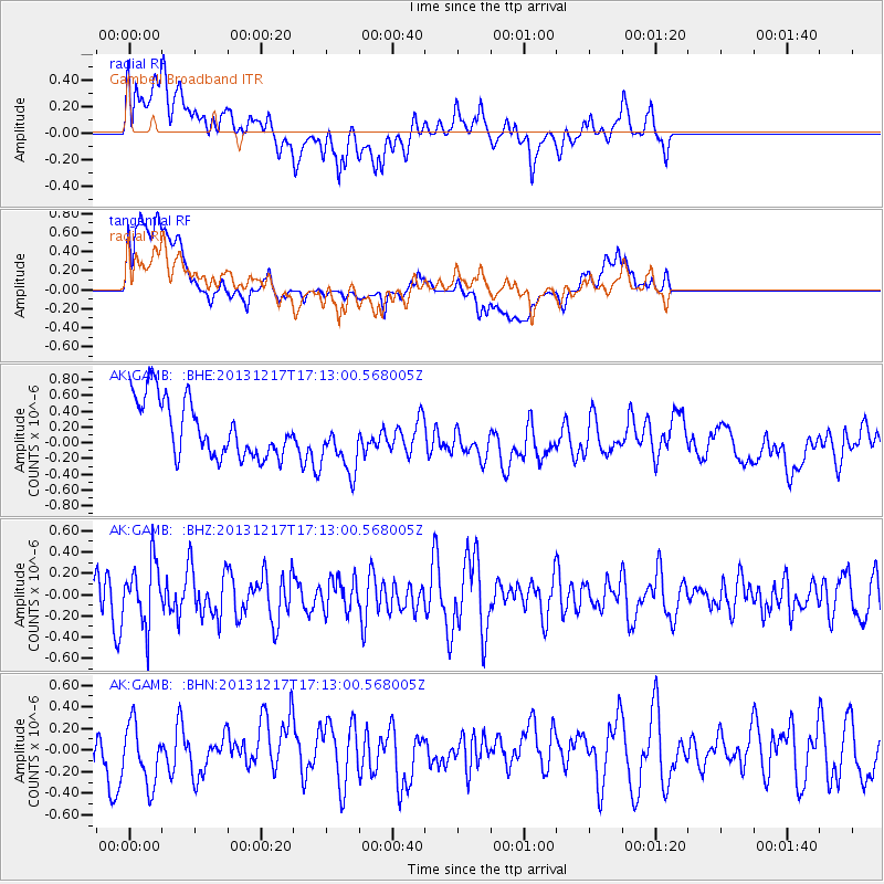
GAMB Gambell Broadband - Earthquake Result Viewer
*The percent match for this event was below the threshold and hence no stack was calculated.
| Earthquake location: |
Fiji Islands Region |
| Earthquake latitude/longitude: |
-20.7/-178.7 |
| Earthquake time(UTC): |
2013/12/17 (351) 17:02:01 GMT |
| Earthquake Depth: |
602 km |
| Earthquake Magnitude: |
5.7 MWB, 5.7 MWC |
| Earthquake Catalog/Contributor: |
NEIC PDE/NEIC COMCAT |
|
| Network: |
AK Alaska Regional Network |
| Station: |
GAMB Gambell Broadband |
| Lat/Lon: |
63.78 N/171.70 W |
| Elevation: |
10 m |
|
| Distance: |
84.4 deg |
| Az: |
3.101 deg |
| Baz: |
186.546 deg |
| Ray Param: |
$rayparam |
*The percent match for this event was below the threshold and hence was not used in the summary stack. |
|
| Radial Match: |
57.671616 % |
| Radial Bump: |
400 |
| Transverse Match: |
47.85229 % |
| Transverse Bump: |
400 |
| SOD ConfigId: |
626651 |
| Insert Time: |
2014-04-20 01:33:02.117 +0000 |
| GWidth: |
2.5 |
| Max Bumps: |
400 |
| Tol: |
0.001 |
|
Signal To Noise
| Channel | StoN | STA | LTA |
| AK:GAMB: :BHZ:20131217T17:13:00.568005Z | 1.52665 | 2.9475999E-7 | 1.9307635E-7 |
| AK:GAMB: :BHN:20131217T17:13:00.568005Z | 1.2779862 | 2.830738E-7 | 2.2149989E-7 |
| AK:GAMB: :BHE:20131217T17:13:00.568005Z | 1.1108929 | 4.064335E-7 | 3.65862E-7 |
| Arrivals |
| Ps | |
| PpPs | |
| PsPs/PpSs | |


