You are here: Home > Network List > BK - Berkeley Digital Seismograph Network Stations List
> Station HUMO Hull Mountain, OR > Earthquake Result Viewer
HUMO Hull Mountain, OR - Earthquake Result Viewer
*The percent match for this event was below the threshold and hence no stack was calculated.
| Earthquake location: |
Fiji Islands Region |
| Earthquake latitude/longitude: |
-20.7/-178.7 |
| Earthquake time(UTC): |
2013/12/17 (351) 17:02:01 GMT |
| Earthquake Depth: |
602 km |
| Earthquake Magnitude: |
5.7 MWB, 5.7 MWC |
| Earthquake Catalog/Contributor: |
NEIC PDE/NEIC COMCAT |
|
| Network: |
BK Berkeley Digital Seismograph Network |
| Station: |
HUMO Hull Mountain, OR |
| Lat/Lon: |
42.61 N/122.96 W |
| Elevation: |
555 m |
|
| Distance: |
81.2 deg |
| Az: |
38.106 deg |
| Baz: |
231.495 deg |
| Ray Param: |
$rayparam |
*The percent match for this event was below the threshold and hence was not used in the summary stack. |
|
| Radial Match: |
58.1876 % |
| Radial Bump: |
400 |
| Transverse Match: |
54.596584 % |
| Transverse Bump: |
400 |
| SOD ConfigId: |
626651 |
| Insert Time: |
2014-04-20 01:36:46.878 +0000 |
| GWidth: |
2.5 |
| Max Bumps: |
400 |
| Tol: |
0.001 |
|
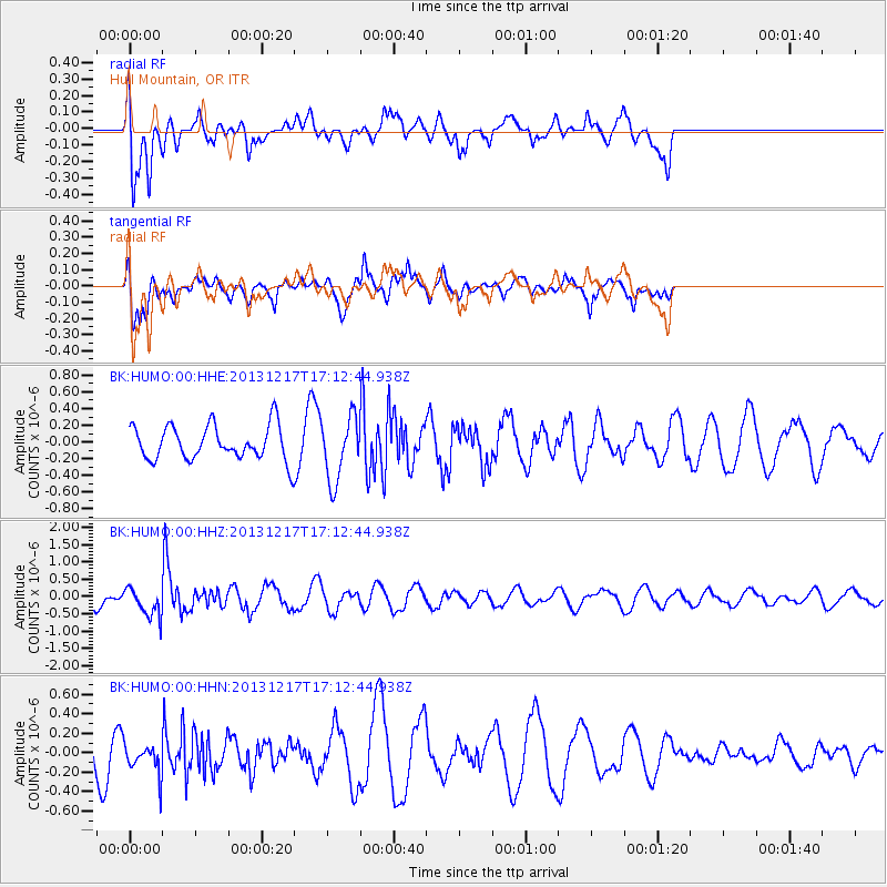
Signal To Noise
| Channel | StoN | STA | LTA |
| BK:HUMO:00:HHZ:20131217T17:12:44.938Z | 1.481397 | 4.1659436E-7 | 2.812172E-7 |
| BK:HUMO:00:HHN:20131217T17:12:44.938Z | 0.48766315 | 1.5368245E-7 | 3.151406E-7 |
| BK:HUMO:00:HHE:20131217T17:12:44.938Z | 1.8744792 | 3.8243292E-7 | 2.0402089E-7 |
| Arrivals |
| Ps | |
| PpPs | |
| PsPs/PpSs | |


