You are here: Home > Network List > TA - USArray Transportable Network (new EarthScope stations) Stations List
> Station HDA Harding Lake, AK, USA > Earthquake Result Viewer
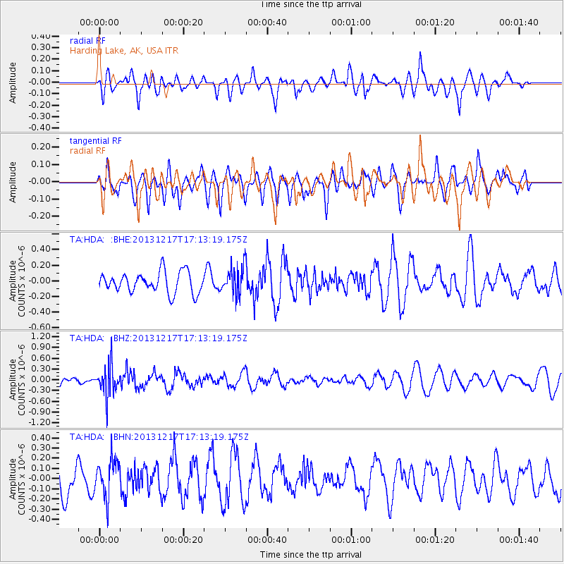
HDA Harding Lake, AK, USA - Earthquake Result Viewer
*The percent match for this event was below the threshold and hence no stack was calculated.
| Earthquake location: |
Fiji Islands Region |
| Earthquake latitude/longitude: |
-20.7/-178.7 |
| Earthquake time(UTC): |
2013/12/17 (351) 17:02:01 GMT |
| Earthquake Depth: |
602 km |
| Earthquake Magnitude: |
5.7 MWB, 5.7 MWC |
| Earthquake Catalog/Contributor: |
NEIC PDE/NEIC COMCAT |
|
| Network: |
TA USArray Transportable Network (new EarthScope stations) |
| Station: |
HDA Harding Lake, AK, USA |
| Lat/Lon: |
64.41 N/146.95 W |
| Elevation: |
437 m |
|
| Distance: |
88.3 deg |
| Az: |
13.203 deg |
| Baz: |
209.493 deg |
| Ray Param: |
$rayparam |
*The percent match for this event was below the threshold and hence was not used in the summary stack. |
|
| Radial Match: |
49.034782 % |
| Radial Bump: |
400 |
| Transverse Match: |
44.079155 % |
| Transverse Bump: |
400 |
| SOD ConfigId: |
626651 |
| Insert Time: |
2014-04-20 01:43:54.895 +0000 |
| GWidth: |
2.5 |
| Max Bumps: |
400 |
| Tol: |
0.001 |
|
Signal To Noise
| Channel | StoN | STA | LTA |
| TA:HDA: :BHZ:20131217T17:13:19.175Z | 2.1835775 | 4.17795E-7 | 1.913351E-7 |
| TA:HDA: :BHN:20131217T17:13:19.175Z | 1.1343715 | 1.7983899E-7 | 1.5853624E-7 |
| TA:HDA: :BHE:20131217T17:13:19.175Z | 1.3250693 | 1.7584924E-7 | 1.3270947E-7 |
| Arrivals |
| Ps | |
| PpPs | |
| PsPs/PpSs | |


