You are here: Home > Network List > TA - USArray Transportable Network (new EarthScope stations) Stations List
> Station M04C Macdoel, CA, USA > Earthquake Result Viewer
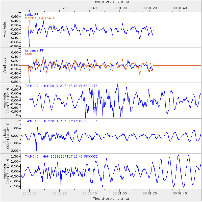
M04C Macdoel, CA, USA - Earthquake Result Viewer
*The percent match for this event was below the threshold and hence no stack was calculated.
| Earthquake location: |
Fiji Islands Region |
| Earthquake latitude/longitude: |
-20.7/-178.7 |
| Earthquake time(UTC): |
2013/12/17 (351) 17:02:01 GMT |
| Earthquake Depth: |
602 km |
| Earthquake Magnitude: |
5.7 MWB, 5.7 MWC |
| Earthquake Catalog/Contributor: |
NEIC PDE/NEIC COMCAT |
|
| Network: |
TA USArray Transportable Network (new EarthScope stations) |
| Station: |
M04C Macdoel, CA, USA |
| Lat/Lon: |
41.78 N/121.84 W |
| Elevation: |
1391 m |
|
| Distance: |
81.4 deg |
| Az: |
39.28 deg |
| Baz: |
232.42 deg |
| Ray Param: |
$rayparam |
*The percent match for this event was below the threshold and hence was not used in the summary stack. |
|
| Radial Match: |
52.836372 % |
| Radial Bump: |
400 |
| Transverse Match: |
42.09357 % |
| Transverse Bump: |
400 |
| SOD ConfigId: |
626651 |
| Insert Time: |
2014-04-20 01:44:18.714 +0000 |
| GWidth: |
2.5 |
| Max Bumps: |
400 |
| Tol: |
0.001 |
|
Signal To Noise
| Channel | StoN | STA | LTA |
| TA:M04C: :HHZ:20131217T17:12:45.680005Z | 2.8768635 | 6.781638E-7 | 2.3573025E-7 |
| TA:M04C: :HHN:20131217T17:12:45.680005Z | 0.51546216 | 2.5022942E-7 | 4.854467E-7 |
| TA:M04C: :HHE:20131217T17:12:45.680005Z | 0.9628481 | 3.586248E-7 | 3.7246247E-7 |
| Arrivals |
| Ps | |
| PpPs | |
| PsPs/PpSs | |


