You are here: Home > Network List > TA - USArray Transportable Network (new EarthScope stations) Stations List
> Station POKR Poker Plat Research Range, AK, USA > Earthquake Result Viewer
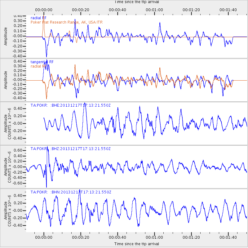
POKR Poker Plat Research Range, AK, USA - Earthquake Result Viewer
*The percent match for this event was below the threshold and hence no stack was calculated.
| Earthquake location: |
Fiji Islands Region |
| Earthquake latitude/longitude: |
-20.7/-178.7 |
| Earthquake time(UTC): |
2013/12/17 (351) 17:02:01 GMT |
| Earthquake Depth: |
602 km |
| Earthquake Magnitude: |
5.7 MWB, 5.7 MWC |
| Earthquake Catalog/Contributor: |
NEIC PDE/NEIC COMCAT |
|
| Network: |
TA USArray Transportable Network (new EarthScope stations) |
| Station: |
POKR Poker Plat Research Range, AK, USA |
| Lat/Lon: |
65.12 N/147.43 W |
| Elevation: |
501 m |
|
| Distance: |
88.8 deg |
| Az: |
12.673 deg |
| Baz: |
209.042 deg |
| Ray Param: |
$rayparam |
*The percent match for this event was below the threshold and hence was not used in the summary stack. |
|
| Radial Match: |
44.723946 % |
| Radial Bump: |
400 |
| Transverse Match: |
47.17771 % |
| Transverse Bump: |
353 |
| SOD ConfigId: |
626651 |
| Insert Time: |
2014-04-20 01:44:25.995 +0000 |
| GWidth: |
2.5 |
| Max Bumps: |
400 |
| Tol: |
0.001 |
|
Signal To Noise
| Channel | StoN | STA | LTA |
| TA:POKR: :BHZ:20131217T17:13:21.550Z | 3.0110447 | 3.7638557E-7 | 1.2500166E-7 |
| TA:POKR: :BHN:20131217T17:13:21.550Z | 1.1615477 | 2.1600313E-7 | 1.859615E-7 |
| TA:POKR: :BHE:20131217T17:13:21.550Z | 0.51290244 | 1.0799905E-7 | 2.105645E-7 |
| Arrivals |
| Ps | |
| PpPs | |
| PsPs/PpSs | |


