You are here: Home > Network List > AV - Alaska Volcano Observatory Stations List
> Station AUJA Augustine Cone H, Augustine Volcano, Alaska > Earthquake Result Viewer
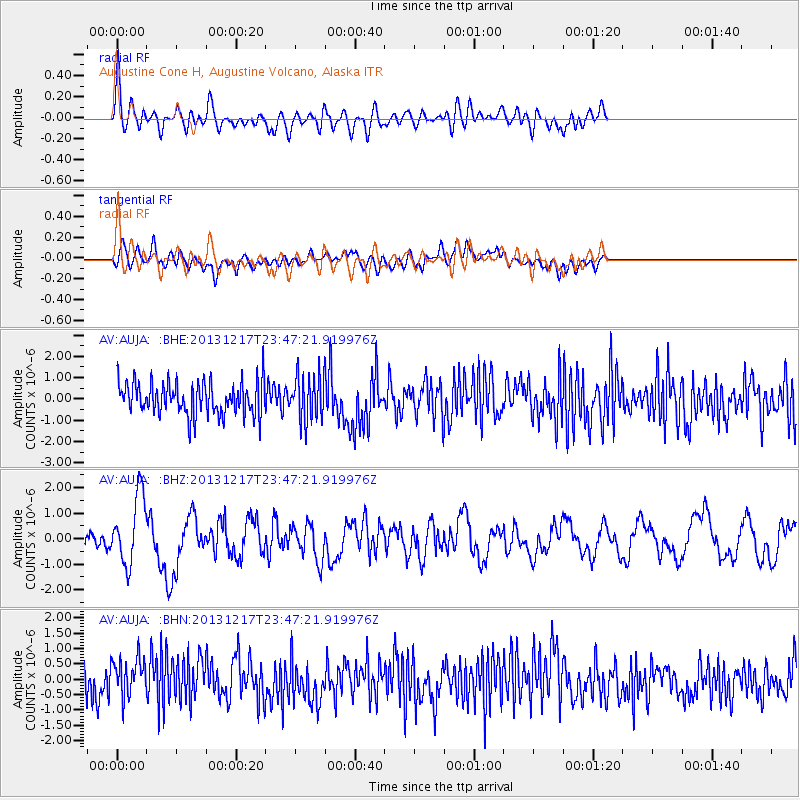
AUJA Augustine Cone H, Augustine Volcano, Alaska - Earthquake Result Viewer
*The percent match for this event was below the threshold and hence no stack was calculated.
| Earthquake location: |
Mariana Islands Region |
| Earthquake latitude/longitude: |
20.8/146.8 |
| Earthquake time(UTC): |
2013/12/17 (351) 23:38:06 GMT |
| Earthquake Depth: |
9.0 km |
| Earthquake Magnitude: |
6.2 MWW, 6.1 MWB, 6.2 MWC, 6.4 MWC |
| Earthquake Catalog/Contributor: |
NEIC PDE/NEIC COMCAT |
|
| Network: |
AV Alaska Volcano Observatory |
| Station: |
AUJA Augustine Cone H, Augustine Volcano, Alaska |
| Lat/Lon: |
59.34 N/153.42 W |
| Elevation: |
376 m |
|
| Distance: |
57.0 deg |
| Az: |
31.86 deg |
| Baz: |
254.539 deg |
| Ray Param: |
$rayparam |
*The percent match for this event was below the threshold and hence was not used in the summary stack. |
|
| Radial Match: |
54.630913 % |
| Radial Bump: |
400 |
| Transverse Match: |
55.685524 % |
| Transverse Bump: |
400 |
| SOD ConfigId: |
626651 |
| Insert Time: |
2014-04-20 01:53:24.024 +0000 |
| GWidth: |
2.5 |
| Max Bumps: |
400 |
| Tol: |
0.001 |
|
Signal To Noise
| Channel | StoN | STA | LTA |
| AV:AUJA: :BHZ:20131217T23:47:21.919976Z | 3.7239015 | 1.3436508E-6 | 3.60818E-7 |
| AV:AUJA: :BHN:20131217T23:47:21.919976Z | 1.1595657 | 6.5876225E-7 | 5.681112E-7 |
| AV:AUJA: :BHE:20131217T23:47:21.919976Z | 1.3463016 | 1.0527126E-6 | 7.8192926E-7 |
| Arrivals |
| Ps | |
| PpPs | |
| PsPs/PpSs | |


