You are here: Home > Network List > KN - Kyrgyz Seismic Telemetry Network Stations List
> Station TKM2 - > Earthquake Result Viewer
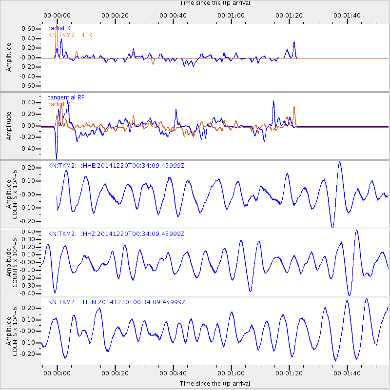
TKM2 - - Earthquake Result Viewer
*The percent match for this event was below the threshold and hence no stack was calculated.
| Earthquake location: |
Philippine Islands Region |
| Earthquake latitude/longitude: |
11.6/126.3 |
| Earthquake time(UTC): |
2014/12/20 (354) 00:25:17 GMT |
| Earthquake Depth: |
2.0 km |
| Earthquake Magnitude: |
6.0 mb, 5.1 ML, 5.6 MS |
| Earthquake Catalog/Contributor: |
ISC/ISC |
|
| Network: |
KN Kyrgyz Seismic Telemetry Network |
| Station: |
TKM2 - |
| Lat/Lon: |
42.92 N/75.60 E |
| Elevation: |
2020 m |
|
| Distance: |
53.7 deg |
| Az: |
315.152 deg |
| Baz: |
109.857 deg |
| Ray Param: |
$rayparam |
*The percent match for this event was below the threshold and hence was not used in the summary stack. |
|
| Radial Match: |
66.77491 % |
| Radial Bump: |
400 |
| Transverse Match: |
63.12131 % |
| Transverse Bump: |
400 |
| SOD ConfigId: |
3390531 |
| Insert Time: |
2019-04-15 16:39:21.393 +0000 |
| GWidth: |
2.5 |
| Max Bumps: |
400 |
| Tol: |
0.001 |
|
Signal To Noise
| Channel | StoN | STA | LTA |
| KN:TKM2: :HHZ:20141220T00:34:09.45999Z | 4.9694753 | 2.010463E-7 | 4.0456243E-8 |
| KN:TKM2: :HHN:20141220T00:34:09.45999Z | 1.2564331 | 1.5388353E-7 | 1.2247651E-7 |
| KN:TKM2: :HHE:20141220T00:34:09.45999Z | 0.86121905 | 6.97132E-8 | 8.094712E-8 |
| Arrivals |
| Ps | |
| PpPs | |
| PsPs/PpSs | |


