You are here: Home > Network List > US - United States National Seismic Network Stations List
> Station LAO LASA Array, Montana, USA > Earthquake Result Viewer
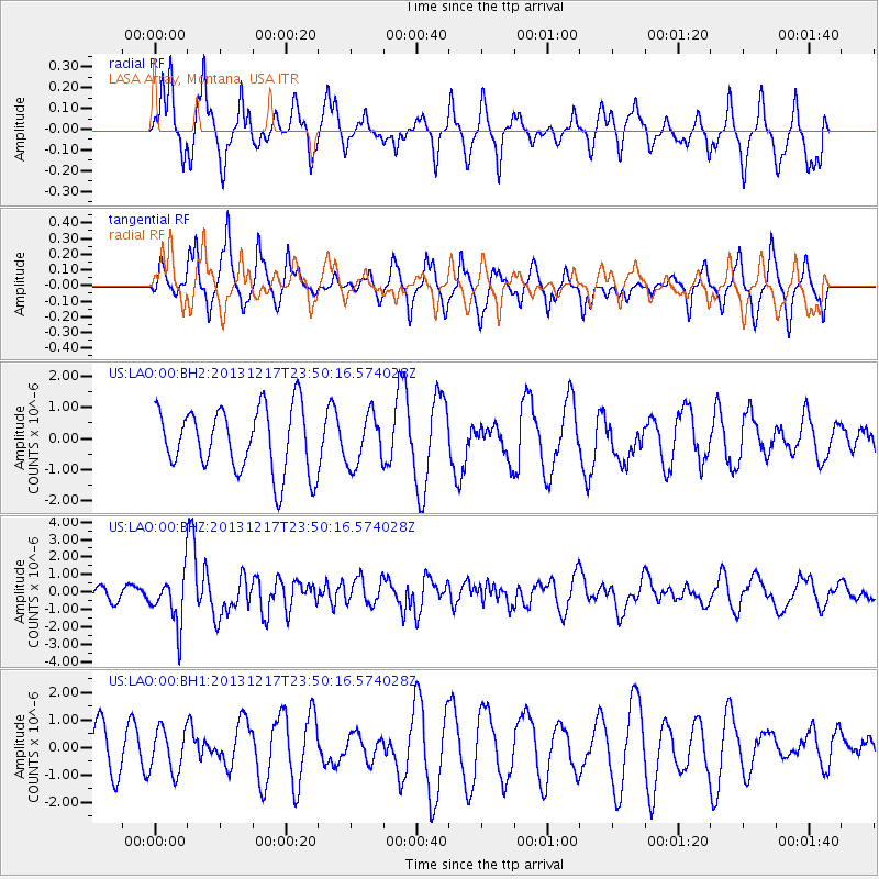
LAO LASA Array, Montana, USA - Earthquake Result Viewer
*The percent match for this event was below the threshold and hence no stack was calculated.
| Earthquake location: |
Mariana Islands Region |
| Earthquake latitude/longitude: |
20.8/146.8 |
| Earthquake time(UTC): |
2013/12/17 (351) 23:38:06 GMT |
| Earthquake Depth: |
9.0 km |
| Earthquake Magnitude: |
6.2 MWW, 6.1 MWB, 6.2 MWC, 6.4 MWC |
| Earthquake Catalog/Contributor: |
NEIC PDE/NEIC COMCAT |
|
| Network: |
US United States National Seismic Network |
| Station: |
LAO LASA Array, Montana, USA |
| Lat/Lon: |
46.69 N/106.22 W |
| Elevation: |
902 m |
|
| Distance: |
86.1 deg |
| Az: |
41.29 deg |
| Baz: |
296.233 deg |
| Ray Param: |
$rayparam |
*The percent match for this event was below the threshold and hence was not used in the summary stack. |
|
| Radial Match: |
58.227825 % |
| Radial Bump: |
384 |
| Transverse Match: |
58.119396 % |
| Transverse Bump: |
285 |
| SOD ConfigId: |
626651 |
| Insert Time: |
2014-04-20 02:10:59.641 +0000 |
| GWidth: |
2.5 |
| Max Bumps: |
400 |
| Tol: |
0.001 |
|
Signal To Noise
| Channel | StoN | STA | LTA |
| US:LAO:00:BHZ:20131217T23:50:16.574028Z | 5.122837 | 1.4270225E-6 | 2.7856098E-7 |
| US:LAO:00:BH1:20131217T23:50:16.574028Z | 0.741575 | 7.85708E-7 | 1.0595126E-6 |
| US:LAO:00:BH2:20131217T23:50:16.574028Z | 0.7872753 | 8.109951E-7 | 1.0301289E-6 |
| Arrivals |
| Ps | |
| PpPs | |
| PsPs/PpSs | |


