You are here: Home > Network List > UW - Pacific Northwest Regional Seismic Network Stations List
> Station LEBA Lebam, WA, USA > Earthquake Result Viewer
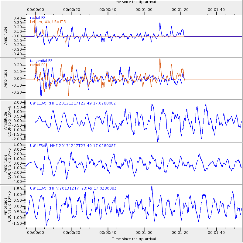
LEBA Lebam, WA, USA - Earthquake Result Viewer
*The percent match for this event was below the threshold and hence no stack was calculated.
| Earthquake location: |
Mariana Islands Region |
| Earthquake latitude/longitude: |
20.8/146.8 |
| Earthquake time(UTC): |
2013/12/17 (351) 23:38:06 GMT |
| Earthquake Depth: |
9.0 km |
| Earthquake Magnitude: |
6.2 MWW, 6.1 MWB, 6.2 MWC, 6.4 MWC |
| Earthquake Catalog/Contributor: |
NEIC PDE/NEIC COMCAT |
|
| Network: |
UW Pacific Northwest Regional Seismic Network |
| Station: |
LEBA Lebam, WA, USA |
| Lat/Lon: |
46.55 N/123.56 W |
| Elevation: |
73 m |
|
| Distance: |
75.0 deg |
| Az: |
45.61 deg |
| Baz: |
284.338 deg |
| Ray Param: |
$rayparam |
*The percent match for this event was below the threshold and hence was not used in the summary stack. |
|
| Radial Match: |
59.66693 % |
| Radial Bump: |
359 |
| Transverse Match: |
60.796764 % |
| Transverse Bump: |
400 |
| SOD ConfigId: |
626651 |
| Insert Time: |
2014-04-20 02:13:09.920 +0000 |
| GWidth: |
2.5 |
| Max Bumps: |
400 |
| Tol: |
0.001 |
|
Signal To Noise
| Channel | StoN | STA | LTA |
| UW:LEBA: :HHZ:20131217T23:49:17.028008Z | 1.7376648 | 9.981078E-7 | 5.7439604E-7 |
| UW:LEBA: :HHN:20131217T23:49:17.028008Z | 1.2876681 | 7.089E-7 | 5.5053005E-7 |
| UW:LEBA: :HHE:20131217T23:49:17.028008Z | 1.0881245 | 5.789721E-7 | 5.320826E-7 |
| Arrivals |
| Ps | |
| PpPs | |
| PsPs/PpSs | |


