You are here: Home > Network List > IC - New China Digital Seismograph Network Stations List
> Station KMI Kunming, Yunnan Province, China > Earthquake Result Viewer
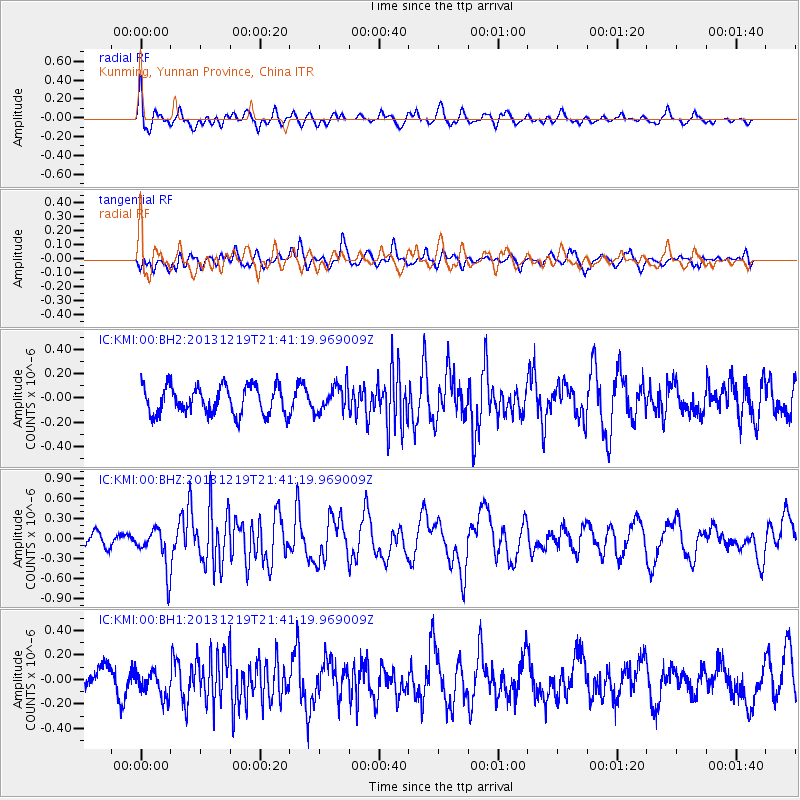
KMI Kunming, Yunnan Province, China - Earthquake Result Viewer
*The percent match for this event was below the threshold and hence no stack was calculated.
| Earthquake location: |
Banda Sea |
| Earthquake latitude/longitude: |
-6.9/128.3 |
| Earthquake time(UTC): |
2013/12/19 (353) 21:34:12 GMT |
| Earthquake Depth: |
11 km |
| Earthquake Magnitude: |
5.7 MWB, 5.5 MWC |
| Earthquake Catalog/Contributor: |
NEIC PDE/NEIC COMCAT |
|
| Network: |
IC New China Digital Seismograph Network |
| Station: |
KMI Kunming, Yunnan Province, China |
| Lat/Lon: |
25.12 N/102.74 E |
| Elevation: |
1975 m |
|
| Distance: |
40.4 deg |
| Az: |
322.865 deg |
| Baz: |
138.608 deg |
| Ray Param: |
$rayparam |
*The percent match for this event was below the threshold and hence was not used in the summary stack. |
|
| Radial Match: |
70.74145 % |
| Radial Bump: |
400 |
| Transverse Match: |
71.57431 % |
| Transverse Bump: |
400 |
| SOD ConfigId: |
626651 |
| Insert Time: |
2014-04-20 02:19:04.331 +0000 |
| GWidth: |
2.5 |
| Max Bumps: |
400 |
| Tol: |
0.001 |
|
Signal To Noise
| Channel | StoN | STA | LTA |
| IC:KMI:00:BHZ:20131219T21:41:19.969009Z | 3.3875418 | 3.0704388E-7 | 9.063915E-8 |
| IC:KMI:00:BH1:20131219T21:41:19.969009Z | 1.1034383 | 1.0405996E-7 | 9.4305186E-8 |
| IC:KMI:00:BH2:20131219T21:41:19.969009Z | 0.96356773 | 1.1024264E-7 | 1.1441088E-7 |
| Arrivals |
| Ps | |
| PpPs | |
| PsPs/PpSs | |


