You are here: Home > Network List > G - GEOSCOPE Stations List
> Station CLF Chambon la Foret observatory, France > Earthquake Result Viewer
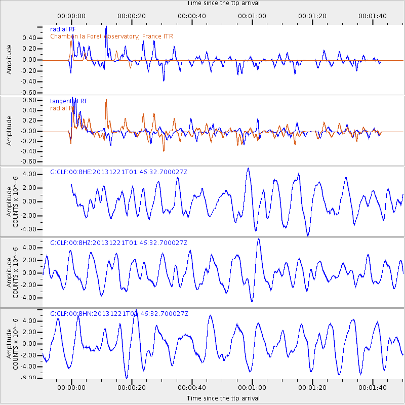
CLF Chambon la Foret observatory, France - Earthquake Result Viewer
*The percent match for this event was below the threshold and hence no stack was calculated.
| Earthquake location: |
Near East Coast Of Honshu, Japan |
| Earthquake latitude/longitude: |
35.6/140.6 |
| Earthquake time(UTC): |
2013/12/21 (355) 01:34:13 GMT |
| Earthquake Depth: |
35 km |
| Earthquake Magnitude: |
5.5 MWB, 5.6 MWC |
| Earthquake Catalog/Contributor: |
NEIC PDE/NEIC COMCAT |
|
| Network: |
G GEOSCOPE |
| Station: |
CLF Chambon la Foret observatory, France |
| Lat/Lon: |
48.03 N/2.26 E |
| Elevation: |
145 m |
|
| Distance: |
88.8 deg |
| Az: |
333.521 deg |
| Baz: |
32.768 deg |
| Ray Param: |
$rayparam |
*The percent match for this event was below the threshold and hence was not used in the summary stack. |
|
| Radial Match: |
57.80225 % |
| Radial Bump: |
389 |
| Transverse Match: |
72.08314 % |
| Transverse Bump: |
351 |
| SOD ConfigId: |
626651 |
| Insert Time: |
2014-04-20 02:29:26.394 +0000 |
| GWidth: |
2.5 |
| Max Bumps: |
400 |
| Tol: |
0.001 |
|
Signal To Noise
| Channel | StoN | STA | LTA |
| G:CLF:00:BHZ:20131221T01:46:32.700027Z | 1.5243952 | 2.0353873E-6 | 1.3352097E-6 |
| G:CLF:00:BHN:20131221T01:46:32.700027Z | 1.5923127 | 2.8259967E-6 | 1.774775E-6 |
| G:CLF:00:BHE:20131221T01:46:32.700027Z | 1.1274413 | 1.442639E-6 | 1.2795691E-6 |
| Arrivals |
| Ps | |
| PpPs | |
| PsPs/PpSs | |


