You are here: Home > Network List > IC - New China Digital Seismograph Network Stations List
> Station KMI Kunming, Yunnan Province, China > Earthquake Result Viewer
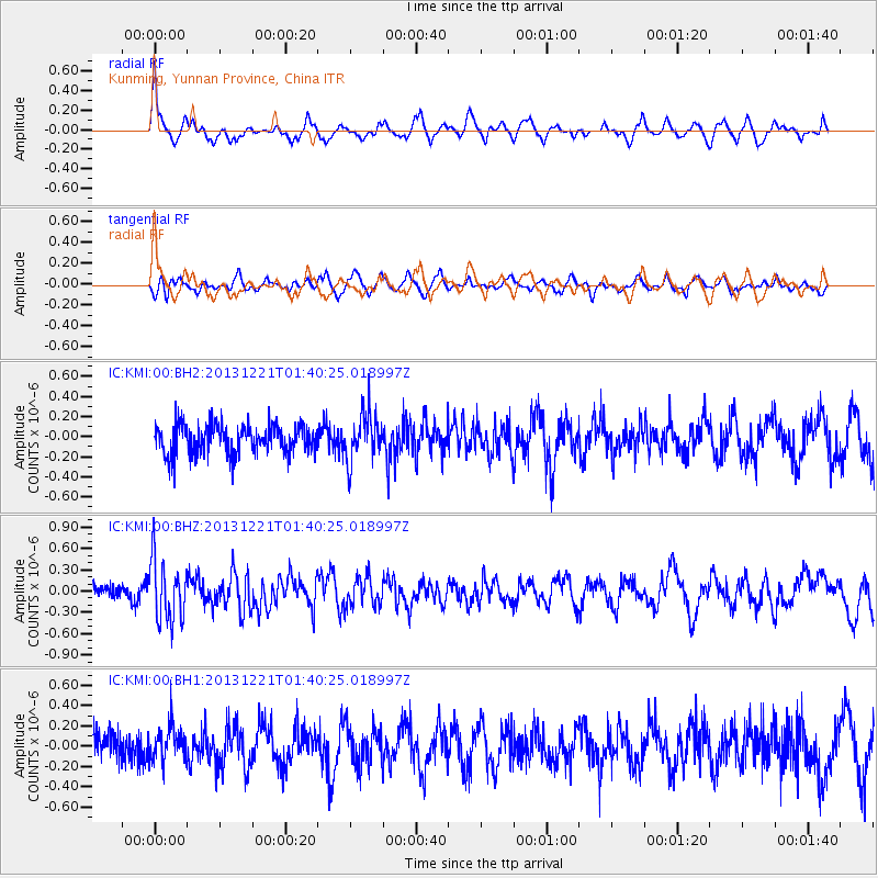
KMI Kunming, Yunnan Province, China - Earthquake Result Viewer
*The percent match for this event was below the threshold and hence no stack was calculated.
| Earthquake location: |
Near East Coast Of Honshu, Japan |
| Earthquake latitude/longitude: |
35.6/140.6 |
| Earthquake time(UTC): |
2013/12/21 (355) 01:34:13 GMT |
| Earthquake Depth: |
35 km |
| Earthquake Magnitude: |
5.5 MWB, 5.6 MWC |
| Earthquake Catalog/Contributor: |
NEIC PDE/NEIC COMCAT |
|
| Network: |
IC New China Digital Seismograph Network |
| Station: |
KMI Kunming, Yunnan Province, China |
| Lat/Lon: |
25.12 N/102.74 E |
| Elevation: |
1975 m |
|
| Distance: |
34.2 deg |
| Az: |
262.788 deg |
| Baz: |
63.104 deg |
| Ray Param: |
$rayparam |
*The percent match for this event was below the threshold and hence was not used in the summary stack. |
|
| Radial Match: |
70.14958 % |
| Radial Bump: |
400 |
| Transverse Match: |
56.12157 % |
| Transverse Bump: |
400 |
| SOD ConfigId: |
626651 |
| Insert Time: |
2014-04-20 02:31:14.548 +0000 |
| GWidth: |
2.5 |
| Max Bumps: |
400 |
| Tol: |
0.001 |
|
Signal To Noise
| Channel | StoN | STA | LTA |
| IC:KMI:00:BHZ:20131221T01:40:25.018997Z | 4.070236 | 4.234668E-7 | 1.0403985E-7 |
| IC:KMI:00:BH1:20131221T01:40:25.018997Z | 1.2324165 | 1.7098955E-7 | 1.3874332E-7 |
| IC:KMI:00:BH2:20131221T01:40:25.018997Z | 1.6436881 | 2.3985973E-7 | 1.4592777E-7 |
| Arrivals |
| Ps | |
| PpPs | |
| PsPs/PpSs | |


