You are here: Home > Network List > II - Global Seismograph Network (GSN - IRIS/IDA) Stations List
> Station WRAB Tennant Creek, NT, Australia > Earthquake Result Viewer
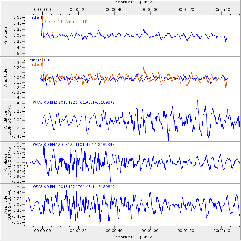
WRAB Tennant Creek, NT, Australia - Earthquake Result Viewer
*The percent match for this event was below the threshold and hence no stack was calculated.
| Earthquake location: |
Near East Coast Of Honshu, Japan |
| Earthquake latitude/longitude: |
35.6/140.6 |
| Earthquake time(UTC): |
2013/12/21 (355) 01:34:13 GMT |
| Earthquake Depth: |
35 km |
| Earthquake Magnitude: |
5.5 MWB, 5.6 MWC |
| Earthquake Catalog/Contributor: |
NEIC PDE/NEIC COMCAT |
|
| Network: |
II Global Seismograph Network (GSN - IRIS/IDA) |
| Station: |
WRAB Tennant Creek, NT, Australia |
| Lat/Lon: |
19.93 S/134.36 E |
| Elevation: |
366 m |
|
| Distance: |
55.6 deg |
| Az: |
187.18 deg |
| Baz: |
6.215 deg |
| Ray Param: |
$rayparam |
*The percent match for this event was below the threshold and hence was not used in the summary stack. |
|
| Radial Match: |
58.96696 % |
| Radial Bump: |
400 |
| Transverse Match: |
49.769516 % |
| Transverse Bump: |
400 |
| SOD ConfigId: |
626651 |
| Insert Time: |
2014-04-20 02:31:50.147 +0000 |
| GWidth: |
2.5 |
| Max Bumps: |
400 |
| Tol: |
0.001 |
|
Signal To Noise
| Channel | StoN | STA | LTA |
| II:WRAB:00:BHZ:20131221T01:43:14.818984Z | 3.2411742 | 4.6542695E-7 | 1.4359824E-7 |
| II:WRAB:00:BH1:20131221T01:43:14.818984Z | 1.3180805 | 2.0725422E-7 | 1.5723941E-7 |
| II:WRAB:00:BH2:20131221T01:43:14.818984Z | 1.1345817 | 1.2543534E-7 | 1.1055646E-7 |
| Arrivals |
| Ps | |
| PpPs | |
| PsPs/PpSs | |


