You are here: Home > Network List > IU - Global Seismograph Network (GSN - IRIS/USGS) Stations List
> Station MAKZ Makanchi, Kazakhstan > Earthquake Result Viewer
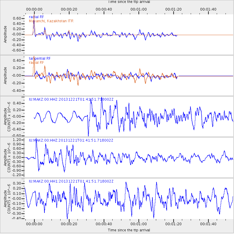
MAKZ Makanchi, Kazakhstan - Earthquake Result Viewer
*The percent match for this event was below the threshold and hence no stack was calculated.
| Earthquake location: |
Near East Coast Of Honshu, Japan |
| Earthquake latitude/longitude: |
35.6/140.6 |
| Earthquake time(UTC): |
2013/12/21 (355) 01:34:13 GMT |
| Earthquake Depth: |
35 km |
| Earthquake Magnitude: |
5.5 MWB, 5.6 MWC |
| Earthquake Catalog/Contributor: |
NEIC PDE/NEIC COMCAT |
|
| Network: |
IU Global Seismograph Network (GSN - IRIS/USGS) |
| Station: |
MAKZ Makanchi, Kazakhstan |
| Lat/Lon: |
46.81 N/81.98 E |
| Elevation: |
600 m |
|
| Distance: |
44.6 deg |
| Az: |
303.287 deg |
| Baz: |
82.615 deg |
| Ray Param: |
$rayparam |
*The percent match for this event was below the threshold and hence was not used in the summary stack. |
|
| Radial Match: |
79.42114 % |
| Radial Bump: |
400 |
| Transverse Match: |
51.876472 % |
| Transverse Bump: |
400 |
| SOD ConfigId: |
626651 |
| Insert Time: |
2014-04-20 02:32:22.106 +0000 |
| GWidth: |
2.5 |
| Max Bumps: |
400 |
| Tol: |
0.001 |
|
Signal To Noise
| Channel | StoN | STA | LTA |
| IU:MAKZ:00:HHZ:20131221T01:41:51.718002Z | 7.1765504 | 5.321943E-7 | 7.41574E-8 |
| IU:MAKZ:00:HH1:20131221T01:41:51.718002Z | 0.9534314 | 9.8907385E-8 | 1.0373833E-7 |
| IU:MAKZ:00:HH2:20131221T01:41:51.718002Z | 2.3011334 | 2.5615643E-7 | 1.1131751E-7 |
| Arrivals |
| Ps | |
| PpPs | |
| PsPs/PpSs | |


