You are here: Home > Network List > NI - North-East Italy Broadband Network Stations List
> Station CGRP Cima Grappa > Earthquake Result Viewer
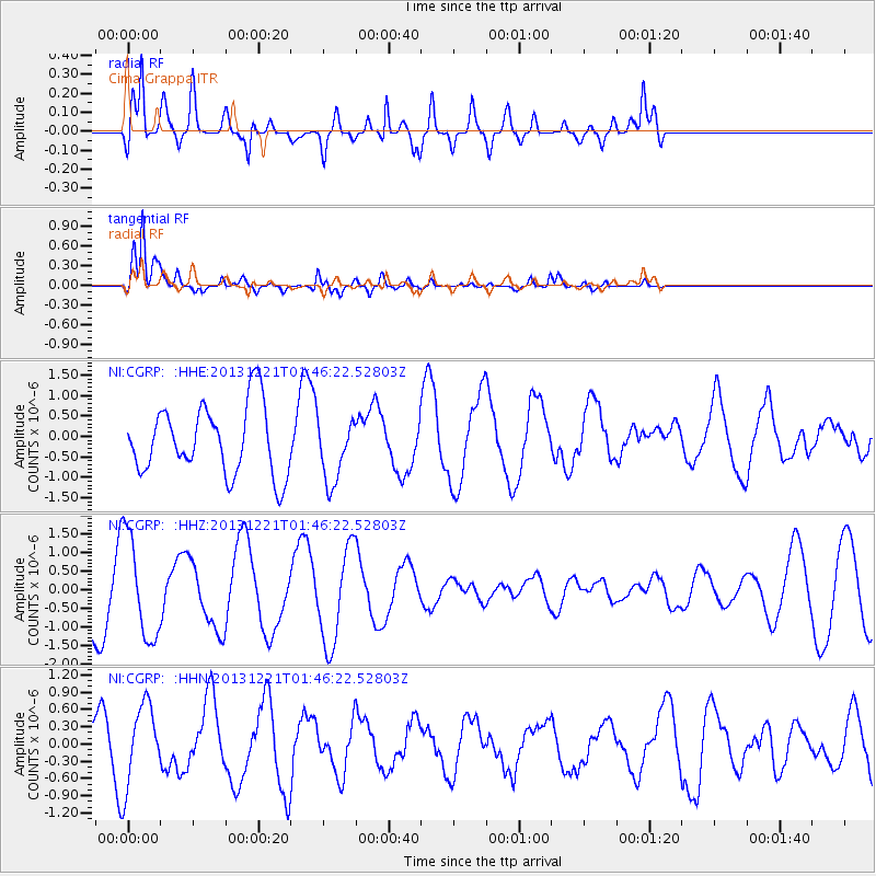
CGRP Cima Grappa - Earthquake Result Viewer
*The percent match for this event was below the threshold and hence no stack was calculated.
| Earthquake location: |
Near East Coast Of Honshu, Japan |
| Earthquake latitude/longitude: |
35.6/140.6 |
| Earthquake time(UTC): |
2013/12/21 (355) 01:34:13 GMT |
| Earthquake Depth: |
35 km |
| Earthquake Magnitude: |
5.5 MWB, 5.6 MWC |
| Earthquake Catalog/Contributor: |
NEIC PDE/NEIC COMCAT |
|
| Network: |
NI North-East Italy Broadband Network |
| Station: |
CGRP Cima Grappa |
| Lat/Lon: |
45.88 N/11.80 E |
| Elevation: |
1757 m |
|
| Distance: |
86.7 deg |
| Az: |
326.977 deg |
| Baz: |
39.474 deg |
| Ray Param: |
$rayparam |
*The percent match for this event was below the threshold and hence was not used in the summary stack. |
|
| Radial Match: |
61.773003 % |
| Radial Bump: |
400 |
| Transverse Match: |
91.55812 % |
| Transverse Bump: |
400 |
| SOD ConfigId: |
626651 |
| Insert Time: |
2014-04-20 02:35:18.637 +0000 |
| GWidth: |
2.5 |
| Max Bumps: |
400 |
| Tol: |
0.001 |
|
Signal To Noise
| Channel | StoN | STA | LTA |
| NI:CGRP: :HHZ:20131221T01:46:22.52803Z | 1.9722339 | 1.3860968E-6 | 7.0280544E-7 |
| NI:CGRP: :HHN:20131221T01:46:22.52803Z | 1.3196309 | 7.1738174E-7 | 5.4362306E-7 |
| NI:CGRP: :HHE:20131221T01:46:22.52803Z | 0.92509764 | 7.8001676E-7 | 8.4317236E-7 |
| Arrivals |
| Ps | |
| PpPs | |
| PsPs/PpSs | |


