You are here: Home > Network List > TA - USArray Transportable Network (new EarthScope stations) Stations List
> Station G03D McMinnville, OR, USA > Earthquake Result Viewer
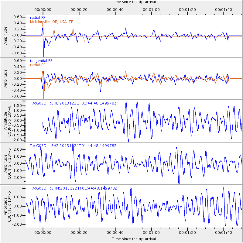
G03D McMinnville, OR, USA - Earthquake Result Viewer
*The percent match for this event was below the threshold and hence no stack was calculated.
| Earthquake location: |
Near East Coast Of Honshu, Japan |
| Earthquake latitude/longitude: |
35.6/140.6 |
| Earthquake time(UTC): |
2013/12/21 (355) 01:34:13 GMT |
| Earthquake Depth: |
35 km |
| Earthquake Magnitude: |
5.5 MWB, 5.6 MWC |
| Earthquake Catalog/Contributor: |
NEIC PDE/NEIC COMCAT |
|
| Network: |
TA USArray Transportable Network (new EarthScope stations) |
| Station: |
G03D McMinnville, OR, USA |
| Lat/Lon: |
45.21 N/123.26 W |
| Elevation: |
222 m |
|
| Distance: |
69.6 deg |
| Az: |
48.593 deg |
| Baz: |
300.16 deg |
| Ray Param: |
$rayparam |
*The percent match for this event was below the threshold and hence was not used in the summary stack. |
|
| Radial Match: |
63.969025 % |
| Radial Bump: |
400 |
| Transverse Match: |
48.782608 % |
| Transverse Bump: |
400 |
| SOD ConfigId: |
626651 |
| Insert Time: |
2014-04-20 02:39:44.804 +0000 |
| GWidth: |
2.5 |
| Max Bumps: |
400 |
| Tol: |
0.001 |
|
Signal To Noise
| Channel | StoN | STA | LTA |
| TA:G03D: :BHZ:20131221T01:44:48.149978Z | 1.4934767 | 1.1517961E-6 | 7.7121797E-7 |
| TA:G03D: :BHN:20131221T01:44:48.149978Z | 1.0983976 | 7.8688413E-7 | 7.163928E-7 |
| TA:G03D: :BHE:20131221T01:44:48.149978Z | 1.0279969 | 7.047374E-7 | 6.855443E-7 |
| Arrivals |
| Ps | |
| PpPs | |
| PsPs/PpSs | |


