You are here: Home > Network List > TA - USArray Transportable Network (new EarthScope stations) Stations List
> Station A04D Lummi Island, WA, USA > Earthquake Result Viewer
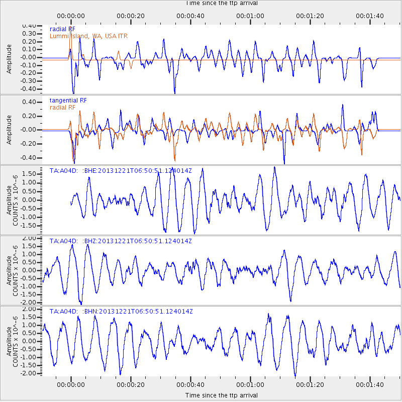
A04D Lummi Island, WA, USA - Earthquake Result Viewer
*The percent match for this event was below the threshold and hence no stack was calculated.
| Earthquake location: |
Southeast Of Loyalty Islands |
| Earthquake latitude/longitude: |
-22.3/171.7 |
| Earthquake time(UTC): |
2013/12/21 (355) 06:38:29 GMT |
| Earthquake Depth: |
122 km |
| Earthquake Magnitude: |
5.5 MWB |
| Earthquake Catalog/Contributor: |
NEIC PDE/NEIC COMCAT |
|
| Network: |
TA USArray Transportable Network (new EarthScope stations) |
| Station: |
A04D Lummi Island, WA, USA |
| Lat/Lon: |
48.72 N/122.71 W |
| Elevation: |
13 m |
|
| Distance: |
91.6 deg |
| Az: |
37.097 deg |
| Baz: |
237.523 deg |
| Ray Param: |
$rayparam |
*The percent match for this event was below the threshold and hence was not used in the summary stack. |
|
| Radial Match: |
75.13409 % |
| Radial Bump: |
400 |
| Transverse Match: |
68.771355 % |
| Transverse Bump: |
318 |
| SOD ConfigId: |
626651 |
| Insert Time: |
2014-04-20 02:55:54.706 +0000 |
| GWidth: |
2.5 |
| Max Bumps: |
400 |
| Tol: |
0.001 |
|
Signal To Noise
| Channel | StoN | STA | LTA |
| TA:A04D: :BHZ:20131221T06:50:51.124014Z | 1.9281998 | 1.2325991E-6 | 6.392486E-7 |
| TA:A04D: :BHN:20131221T06:50:51.124014Z | 1.3797749 | 9.310667E-7 | 6.747961E-7 |
| TA:A04D: :BHE:20131221T06:50:51.124014Z | 2.907393 | 1.3416673E-6 | 4.6146747E-7 |
| Arrivals |
| Ps | |
| PpPs | |
| PsPs/PpSs | |


