You are here: Home > Network List > TA - USArray Transportable Network (new EarthScope stations) Stations List
> Station O03E Paynes Creek, CA, USA > Earthquake Result Viewer
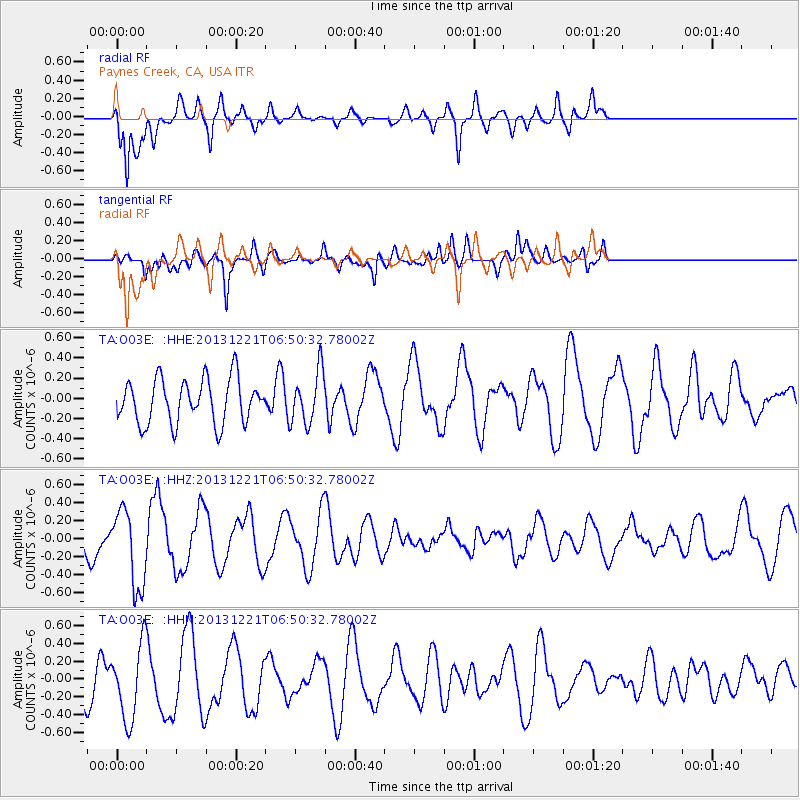
O03E Paynes Creek, CA, USA - Earthquake Result Viewer
*The percent match for this event was below the threshold and hence no stack was calculated.
| Earthquake location: |
Southeast Of Loyalty Islands |
| Earthquake latitude/longitude: |
-22.3/171.7 |
| Earthquake time(UTC): |
2013/12/21 (355) 06:38:29 GMT |
| Earthquake Depth: |
122 km |
| Earthquake Magnitude: |
5.5 MWB |
| Earthquake Catalog/Contributor: |
NEIC PDE/NEIC COMCAT |
|
| Network: |
TA USArray Transportable Network (new EarthScope stations) |
| Station: |
O03E Paynes Creek, CA, USA |
| Lat/Lon: |
40.29 N/121.80 W |
| Elevation: |
967 m |
|
| Distance: |
87.7 deg |
| Az: |
44.573 deg |
| Baz: |
238.199 deg |
| Ray Param: |
$rayparam |
*The percent match for this event was below the threshold and hence was not used in the summary stack. |
|
| Radial Match: |
65.943665 % |
| Radial Bump: |
400 |
| Transverse Match: |
62.941402 % |
| Transverse Bump: |
400 |
| SOD ConfigId: |
626651 |
| Insert Time: |
2014-04-20 02:56:24.654 +0000 |
| GWidth: |
2.5 |
| Max Bumps: |
400 |
| Tol: |
0.001 |
|
Signal To Noise
| Channel | StoN | STA | LTA |
| TA:O03E: :HHZ:20131221T06:50:32.78002Z | 1.8195229 | 4.337268E-7 | 2.3837391E-7 |
| TA:O03E: :HHN:20131221T06:50:32.78002Z | 1.7079163 | 4.3733323E-7 | 2.5606244E-7 |
| TA:O03E: :HHE:20131221T06:50:32.78002Z | 1.1900213 | 2.595955E-7 | 2.181436E-7 |
| Arrivals |
| Ps | |
| PpPs | |
| PsPs/PpSs | |


