You are here: Home > Network List > TA - USArray Transportable Network (new EarthScope stations) Stations List
> Station J49A Marlette, MI, USA > Earthquake Result Viewer
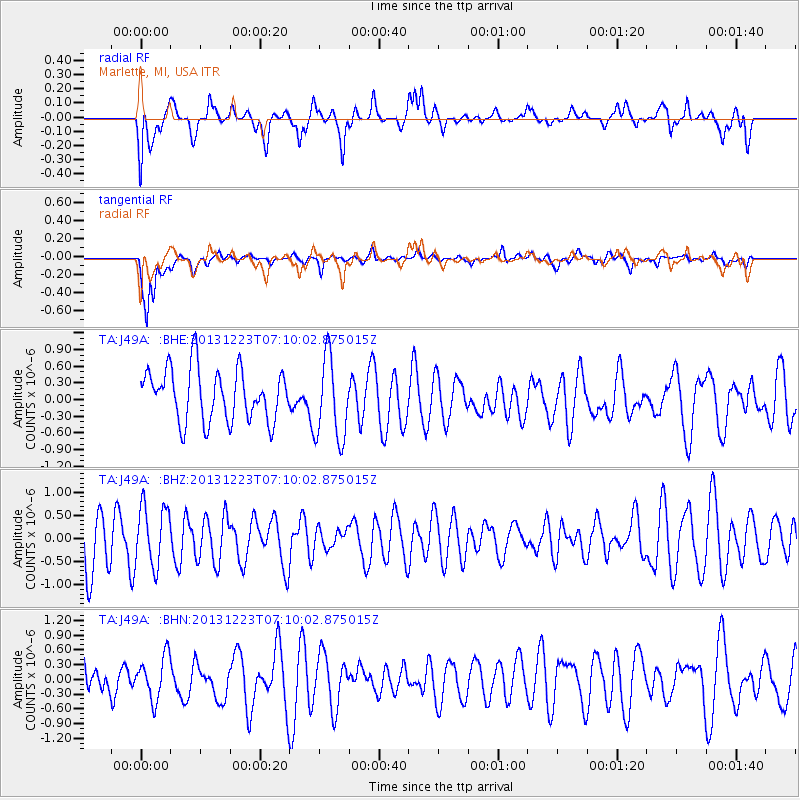
J49A Marlette, MI, USA - Earthquake Result Viewer
*The percent match for this event was below the threshold and hence no stack was calculated.
| Earthquake location: |
Off East Coast Of Honshu, Japan |
| Earthquake latitude/longitude: |
35.7/142.1 |
| Earthquake time(UTC): |
2013/12/23 (357) 06:57:29 GMT |
| Earthquake Depth: |
8.0 km |
| Earthquake Magnitude: |
5.6 MWB, 5.6 MWC |
| Earthquake Catalog/Contributor: |
NEIC PDE/NEIC COMCAT |
|
| Network: |
TA USArray Transportable Network (new EarthScope stations) |
| Station: |
J49A Marlette, MI, USA |
| Lat/Lon: |
43.36 N/83.14 W |
| Elevation: |
253 m |
|
| Distance: |
91.2 deg |
| Az: |
31.221 deg |
| Baz: |
324.652 deg |
| Ray Param: |
$rayparam |
*The percent match for this event was below the threshold and hence was not used in the summary stack. |
|
| Radial Match: |
66.24076 % |
| Radial Bump: |
400 |
| Transverse Match: |
71.93242 % |
| Transverse Bump: |
400 |
| SOD ConfigId: |
626651 |
| Insert Time: |
2014-04-20 03:26:13.687 +0000 |
| GWidth: |
2.5 |
| Max Bumps: |
400 |
| Tol: |
0.001 |
|
Signal To Noise
| Channel | StoN | STA | LTA |
| TA:J49A: :BHZ:20131223T07:10:02.875015Z | 0.95502347 | 6.538617E-7 | 6.846551E-7 |
| TA:J49A: :BHN:20131223T07:10:02.875015Z | 1.0215247 | 4.3572712E-7 | 4.2654585E-7 |
| TA:J49A: :BHE:20131223T07:10:02.875015Z | 1.5989356 | 7.5026395E-7 | 4.692271E-7 |
| Arrivals |
| Ps | |
| PpPs | |
| PsPs/PpSs | |


