You are here: Home > Network List > TA - USArray Transportable Network (new EarthScope stations) Stations List
> Station L46A Eue Claire, MI, USA > Earthquake Result Viewer
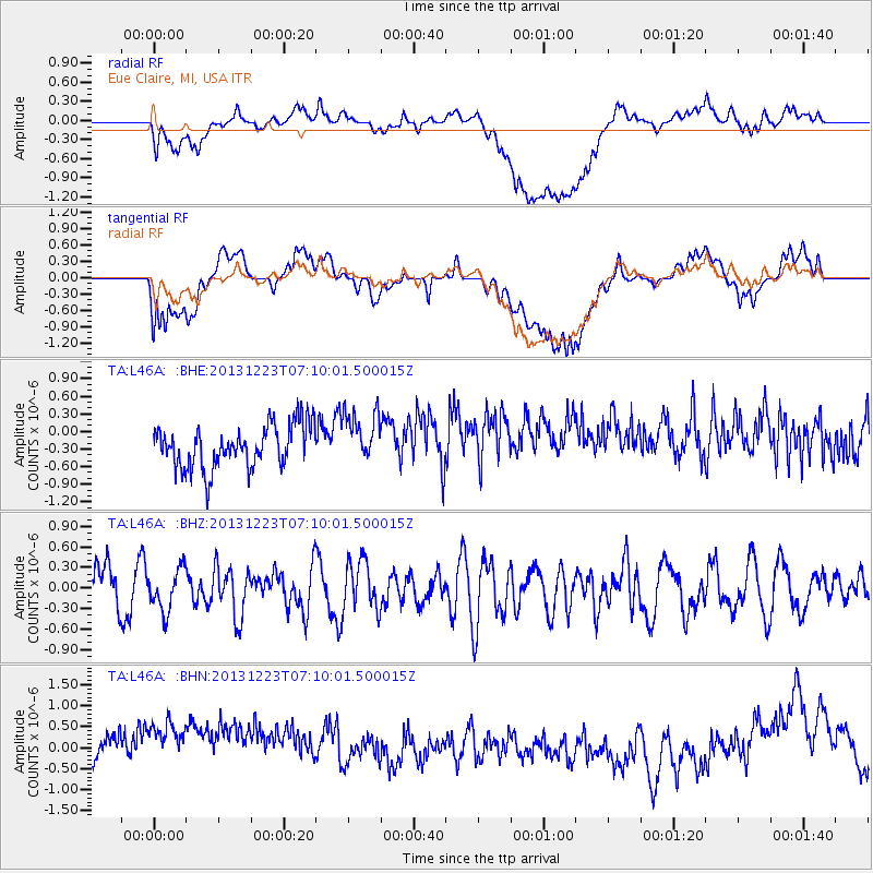
L46A Eue Claire, MI, USA - Earthquake Result Viewer
*The percent match for this event was below the threshold and hence no stack was calculated.
| Earthquake location: |
Off East Coast Of Honshu, Japan |
| Earthquake latitude/longitude: |
35.7/142.1 |
| Earthquake time(UTC): |
2013/12/23 (357) 06:57:29 GMT |
| Earthquake Depth: |
8.0 km |
| Earthquake Magnitude: |
5.6 MWB, 5.6 MWC |
| Earthquake Catalog/Contributor: |
NEIC PDE/NEIC COMCAT |
|
| Network: |
TA USArray Transportable Network (new EarthScope stations) |
| Station: |
L46A Eue Claire, MI, USA |
| Lat/Lon: |
42.01 N/86.30 W |
| Elevation: |
223 m |
|
| Distance: |
90.9 deg |
| Az: |
33.894 deg |
| Baz: |
322.471 deg |
| Ray Param: |
$rayparam |
*The percent match for this event was below the threshold and hence was not used in the summary stack. |
|
| Radial Match: |
47.197884 % |
| Radial Bump: |
400 |
| Transverse Match: |
29.348425 % |
| Transverse Bump: |
400 |
| SOD ConfigId: |
626651 |
| Insert Time: |
2014-04-20 03:26:50.790 +0000 |
| GWidth: |
2.5 |
| Max Bumps: |
400 |
| Tol: |
0.001 |
|
Signal To Noise
| Channel | StoN | STA | LTA |
| TA:L46A: :BHZ:20131223T07:10:01.500015Z | 0.9364067 | 2.9554866E-7 | 3.1561999E-7 |
| TA:L46A: :BHN:20131223T07:10:01.500015Z | 1.694275 | 1.7529272E-6 | 1.0346179E-6 |
| TA:L46A: :BHE:20131223T07:10:01.500015Z | 1.1910619 | 4.360487E-7 | 3.661008E-7 |
| Arrivals |
| Ps | |
| PpPs | |
| PsPs/PpSs | |


