You are here: Home > Network List > TJ - Tajikistan National Seismic Network Stations List
> Station GARM Garm, Tajikistan > Earthquake Result Viewer
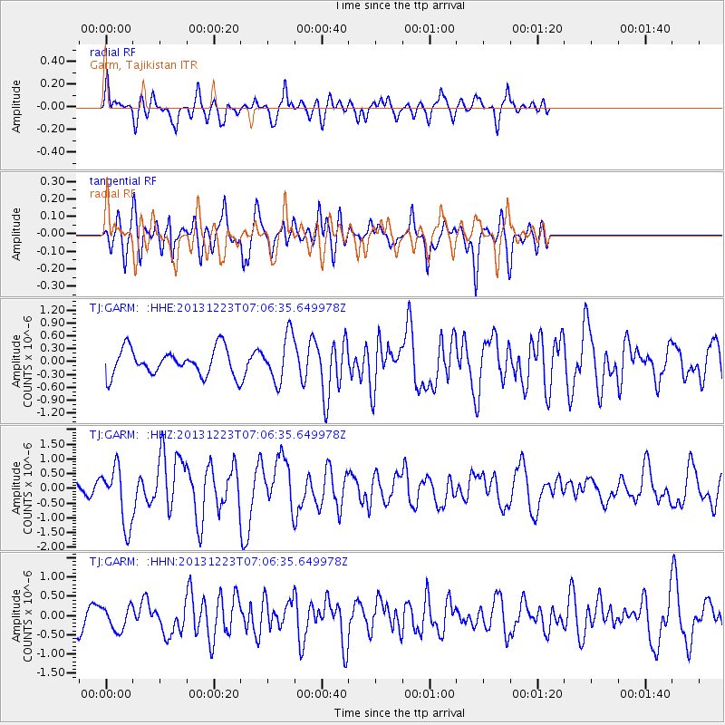
GARM Garm, Tajikistan - Earthquake Result Viewer
*The percent match for this event was below the threshold and hence no stack was calculated.
| Earthquake location: |
Off East Coast Of Honshu, Japan |
| Earthquake latitude/longitude: |
35.7/142.1 |
| Earthquake time(UTC): |
2013/12/23 (357) 06:57:29 GMT |
| Earthquake Depth: |
8.0 km |
| Earthquake Magnitude: |
5.6 MWB, 5.6 MWC |
| Earthquake Catalog/Contributor: |
NEIC PDE/NEIC COMCAT |
|
| Network: |
TJ Tajikistan National Seismic Network |
| Station: |
GARM Garm, Tajikistan |
| Lat/Lon: |
39.00 N/70.32 E |
| Elevation: |
1305 m |
|
| Distance: |
55.8 deg |
| Az: |
296.497 deg |
| Baz: |
69.226 deg |
| Ray Param: |
$rayparam |
*The percent match for this event was below the threshold and hence was not used in the summary stack. |
|
| Radial Match: |
55.68988 % |
| Radial Bump: |
391 |
| Transverse Match: |
69.08873 % |
| Transverse Bump: |
400 |
| SOD ConfigId: |
626651 |
| Insert Time: |
2014-04-20 03:29:42.398 +0000 |
| GWidth: |
2.5 |
| Max Bumps: |
400 |
| Tol: |
0.001 |
|
Signal To Noise
| Channel | StoN | STA | LTA |
| TJ:GARM: :HHZ:20131223T07:06:35.649978Z | 3.4270124 | 9.916411E-7 | 2.8936023E-7 |
| TJ:GARM: :HHN:20131223T07:06:35.649978Z | 0.77473235 | 3.0363984E-7 | 3.9192867E-7 |
| TJ:GARM: :HHE:20131223T07:06:35.649978Z | 1.7614766 | 5.3965243E-7 | 3.063637E-7 |
| Arrivals |
| Ps | |
| PpPs | |
| PsPs/PpSs | |


