You are here: Home > Network List > CN - Canadian National Seismograph Network Stations List
> Station INK INUVIK, NT > Earthquake Result Viewer
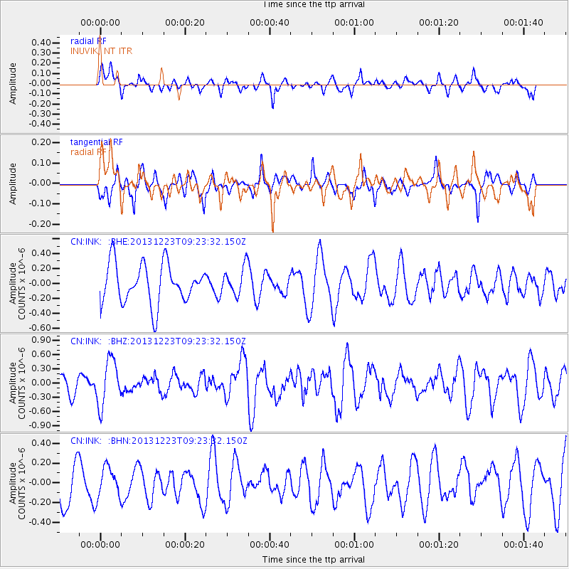
INK INUVIK, NT - Earthquake Result Viewer
*The percent match for this event was below the threshold and hence no stack was calculated.
| Earthquake location: |
South Of Mariana Islands |
| Earthquake latitude/longitude: |
12.8/143.0 |
| Earthquake time(UTC): |
2013/12/23 (357) 09:12:27 GMT |
| Earthquake Depth: |
92 km |
| Earthquake Magnitude: |
5.8 MWW, 5.9 MWC, 5.9 MWB |
| Earthquake Catalog/Contributor: |
NEIC PDE/NEIC COMCAT |
|
| Network: |
CN Canadian National Seismograph Network |
| Station: |
INK INUVIK, NT |
| Lat/Lon: |
68.31 N/133.53 W |
| Elevation: |
44 m |
|
| Distance: |
75.8 deg |
| Az: |
22.396 deg |
| Baz: |
268.71 deg |
| Ray Param: |
$rayparam |
*The percent match for this event was below the threshold and hence was not used in the summary stack. |
|
| Radial Match: |
52.260647 % |
| Radial Bump: |
400 |
| Transverse Match: |
41.83424 % |
| Transverse Bump: |
327 |
| SOD ConfigId: |
626651 |
| Insert Time: |
2014-04-20 03:38:54.301 +0000 |
| GWidth: |
2.5 |
| Max Bumps: |
400 |
| Tol: |
0.001 |
|
Signal To Noise
| Channel | StoN | STA | LTA |
| CN:INK: :BHZ:20131223T09:23:32.150Z | 1.9147627 | 4.921332E-7 | 2.5702047E-7 |
| CN:INK: :BHN:20131223T09:23:32.150Z | 0.6412812 | 1.506251E-7 | 2.3488153E-7 |
| CN:INK: :BHE:20131223T09:23:32.150Z | 0.73692274 | 1.9629225E-7 | 2.663675E-7 |
| Arrivals |
| Ps | |
| PpPs | |
| PsPs/PpSs | |


