You are here: Home > Network List > UW - Pacific Northwest Regional Seismic Network Stations List
> Station HOOD Mt Hood Meadows, OR CREST BB SMO > Earthquake Result Viewer
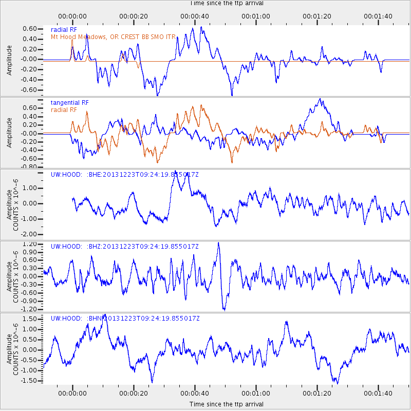
HOOD Mt Hood Meadows, OR CREST BB SMO - Earthquake Result Viewer
*The percent match for this event was below the threshold and hence no stack was calculated.
| Earthquake location: |
South Of Mariana Islands |
| Earthquake latitude/longitude: |
12.8/143.0 |
| Earthquake time(UTC): |
2013/12/23 (357) 09:12:27 GMT |
| Earthquake Depth: |
92 km |
| Earthquake Magnitude: |
5.8 MWW, 5.9 MWC, 5.9 MWB |
| Earthquake Catalog/Contributor: |
NEIC PDE/NEIC COMCAT |
|
| Network: |
UW Pacific Northwest Regional Seismic Network |
| Station: |
HOOD Mt Hood Meadows, OR CREST BB SMO |
| Lat/Lon: |
45.32 N/121.65 W |
| Elevation: |
1520 m |
|
| Distance: |
84.7 deg |
| Az: |
44.868 deg |
| Baz: |
282.702 deg |
| Ray Param: |
$rayparam |
*The percent match for this event was below the threshold and hence was not used in the summary stack. |
|
| Radial Match: |
37.850826 % |
| Radial Bump: |
400 |
| Transverse Match: |
25.938711 % |
| Transverse Bump: |
400 |
| SOD ConfigId: |
626651 |
| Insert Time: |
2014-04-20 03:47:42.020 +0000 |
| GWidth: |
2.5 |
| Max Bumps: |
400 |
| Tol: |
0.001 |
|
Signal To Noise
| Channel | StoN | STA | LTA |
| UW:HOOD: :BHZ:20131223T09:24:19.855017Z | 1.5113101 | 3.7945304E-7 | 2.5107556E-7 |
| UW:HOOD: :BHN:20131223T09:24:19.855017Z | 1.8306057 | 8.2995086E-7 | 4.5337498E-7 |
| UW:HOOD: :BHE:20131223T09:24:19.855017Z | 2.929059 | 1.3511658E-6 | 4.612969E-7 |
| Arrivals |
| Ps | |
| PpPs | |
| PsPs/PpSs | |


