You are here: Home > Network List > WY - Yellowstone Wyoming Seismic Network Stations List
> Station YHH Holmes Hill, YNP, WY, USA > Earthquake Result Viewer
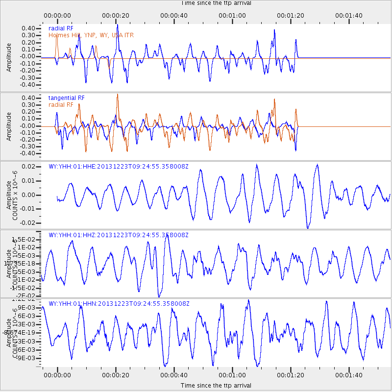
YHH Holmes Hill, YNP, WY, USA - Earthquake Result Viewer
*The percent match for this event was below the threshold and hence no stack was calculated.
| Earthquake location: |
South Of Mariana Islands |
| Earthquake latitude/longitude: |
12.8/143.0 |
| Earthquake time(UTC): |
2013/12/23 (357) 09:12:27 GMT |
| Earthquake Depth: |
92 km |
| Earthquake Magnitude: |
5.8 MWW, 5.9 MWC, 5.9 MWB |
| Earthquake Catalog/Contributor: |
NEIC PDE/NEIC COMCAT |
|
| Network: |
WY Yellowstone Wyoming Seismic Network |
| Station: |
YHH Holmes Hill, YNP, WY, USA |
| Lat/Lon: |
44.79 N/110.85 W |
| Elevation: |
2717 m |
|
| Distance: |
92.2 deg |
| Az: |
43.205 deg |
| Baz: |
290.29 deg |
| Ray Param: |
$rayparam |
*The percent match for this event was below the threshold and hence was not used in the summary stack. |
|
| Radial Match: |
64.516525 % |
| Radial Bump: |
400 |
| Transverse Match: |
63.13423 % |
| Transverse Bump: |
332 |
| SOD ConfigId: |
626651 |
| Insert Time: |
2014-04-20 03:48:14.787 +0000 |
| GWidth: |
2.5 |
| Max Bumps: |
400 |
| Tol: |
0.001 |
|
Signal To Noise
| Channel | StoN | STA | LTA |
| WY:YHH:01:HHZ:20131223T09:24:55.358008Z | 2.0153189 | 9.302898E-9 | 4.616093E-9 |
| WY:YHH:01:HHN:20131223T09:24:55.358008Z | 0.44209287 | 2.975709E-9 | 6.7309593E-9 |
| WY:YHH:01:HHE:20131223T09:24:55.358008Z | 1.1289924 | 5.984381E-9 | 5.3006386E-9 |
| Arrivals |
| Ps | |
| PpPs | |
| PsPs/PpSs | |


