You are here: Home > Network List > AZ - ANZA Regional Network Stations List
> Station LVA2 AZ.LVA2 > Earthquake Result Viewer
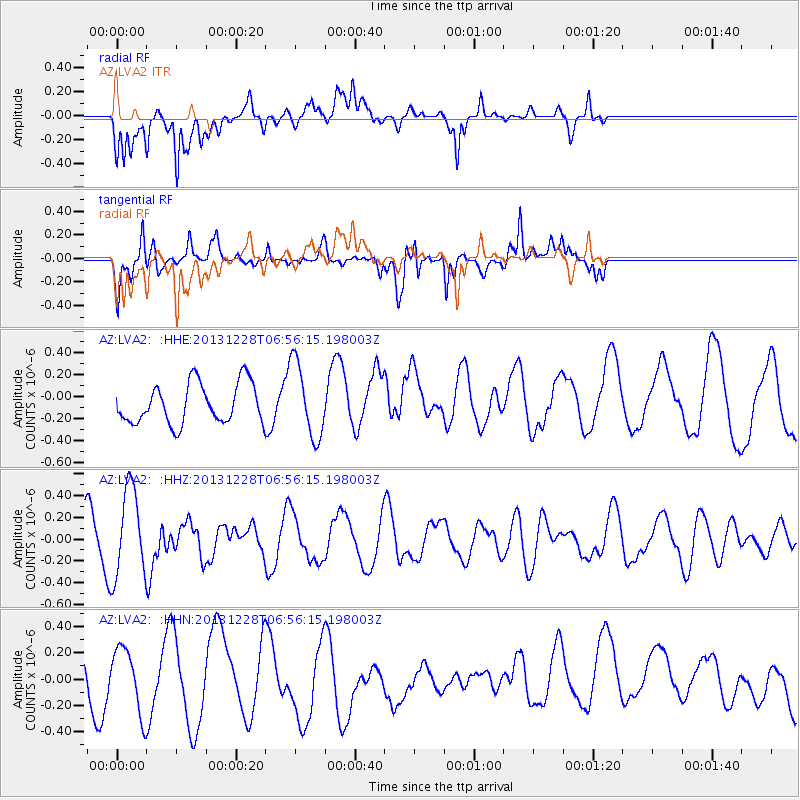
LVA2 AZ.LVA2 - Earthquake Result Viewer
*The percent match for this event was below the threshold and hence no stack was calculated.
| Earthquake location: |
Pacific-Antarctic Ridge |
| Earthquake latitude/longitude: |
-56.4/-142.5 |
| Earthquake time(UTC): |
2013/12/28 (362) 06:43:37 GMT |
| Earthquake Depth: |
10 km |
| Earthquake Magnitude: |
5.6 MWB, 5.6 MWC |
| Earthquake Catalog/Contributor: |
NEIC PDE/NEIC COMCAT |
|
| Network: |
AZ ANZA Regional Network |
| Station: |
LVA2 AZ.LVA2 |
| Lat/Lon: |
33.35 N/116.56 W |
| Elevation: |
1435 m |
|
| Distance: |
92.1 deg |
| Az: |
21.525 deg |
| Baz: |
194.093 deg |
| Ray Param: |
$rayparam |
*The percent match for this event was below the threshold and hence was not used in the summary stack. |
|
| Radial Match: |
73.31433 % |
| Radial Bump: |
400 |
| Transverse Match: |
73.26952 % |
| Transverse Bump: |
400 |
| SOD ConfigId: |
626651 |
| Insert Time: |
2014-04-20 03:50:23.445 +0000 |
| GWidth: |
2.5 |
| Max Bumps: |
400 |
| Tol: |
0.001 |
|
Signal To Noise
| Channel | StoN | STA | LTA |
| AZ:LVA2: :HHZ:20131228T06:56:15.198003Z | 1.9936016 | 4.039788E-7 | 2.0263766E-7 |
| AZ:LVA2: :HHN:20131228T06:56:15.198003Z | 1.1484923 | 2.387448E-7 | 2.078767E-7 |
| AZ:LVA2: :HHE:20131228T06:56:15.198003Z | 1.8826433 | 3.4060665E-7 | 1.8091937E-7 |
| Arrivals |
| Ps | |
| PpPs | |
| PsPs/PpSs | |


